Indoor Mapping with Terrestrial Photogrammetry
Swiss engineering and geomatics consulting firm Mosini Caviezel SA has been testing terrestrial photogrammetry for indoor mapping as a new method for establishing property plans. The company is evaluating the optimal indoor mapping workflow and testing different positions and methods for data capture.
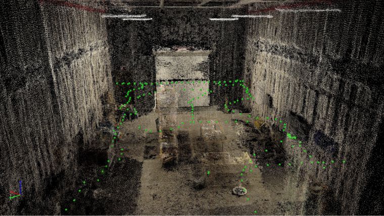
The project consisted of several phases and took place in an office building of Mosini Caviezel SA, Switzerland: a rural house that includes five rooms and a large hallway. The main objectives were to create an indoor plan in 2D, evaluate the application of terrestrial photogrammetry for establishing a PPE (Propriété Par Étages/property by floors, or condominium ownership of an apartment) plan, and find out an optimal protocol for surveying and architecture companies to document property indoors that is of low cost and sustainable.
The first phase was to acquire images in different ways, to figure out the ones which give the best results. Using the photogrammetry software Pix4Dmapper, it was easy to assess the quality of each method and to continue to the following step – scaling the project to obtain precise measurements. In the final phase, all processed Pix4D projects were analysed and compared in order to assess the feasibility of the workflow and to sum up for a protocol in the near future.
The full story, including an overview of the data acquisition and results from various acquisition angles in different survey areas can be found here.

Value staying current with geomatics?
Stay on the map with our expertly curated newsletters.
We provide educational insights, industry updates, and inspiring stories to help you learn, grow, and reach your full potential in your field. Don't miss out - subscribe today and ensure you're always informed, educated, and inspired.
Choose your newsletter(s)


