Indoor Mobile Mapping Solution
Trimble's Indoor Mobile Mapping System (TIMMS) is a manually operated push-cart designed to accurately model interior spaces without accessing GPS. It consists of 3 core elements: Lidar and camera systems engineered to work indoors in mobile mode, computers and electronics for completing data acquisition, and data processing workflow for producing final 2D/3D maps and models. The models are geolocated, meaning that the real-world position of each area is known.
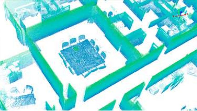
A walk-through of an interior space with TIMMS delivers full 360-degree coverage. The spatial data is captured and georeferenced in real time. Thousands of square feet are mapped in minutes, entire buildings in a single day.
TIMMS is ideal for many applications, including Emergency Response. According to Northwood Chief of Police Leo Dorsey in Worth County, Iowa, any building can be the scene of an emergency where people are in danger. The emergency services need to be able to ‘see’ what we are getting into, plan our route and prepare for all the possibilities.
For Northwood-Kensett High School of Worth County, accurate blueprints were non-existent and any response to an emergency would be “blind” to its structure and layout – a very difficult task. Accurate blueprint and spatial information of the inside of the school was urgently needed. The time to acquire the necessary data for all 90 rooms of the school using traditional static scanning was estimated at one week and the associated processing of the data was estimated at another two weeks. This was deemed too time-consuming and costly. A faster and more cost-effective solution was needed. After an extensive search, Trimble’s Indoor Mobile Mapping System (TIMMS) was selected, resulting in cost and time savings as using TIMMS, the entire school was scanned in 5 hours. Processing the collected data and making it available to the customer was done in just 8 additional hours. The reduction in time-to-completion compared to the static method was 92%. Total cost savings achieved were 50% of the traditional method.

Value staying current with geomatics?
Stay on the map with our expertly curated newsletters.
We provide educational insights, industry updates, and inspiring stories to help you learn, grow, and reach your full potential in your field. Don't miss out - subscribe today and ensure you're always informed, educated, and inspired.
Choose your newsletter(s)


