Intergeo 2016: Smart Geoinformation Shaping the Future
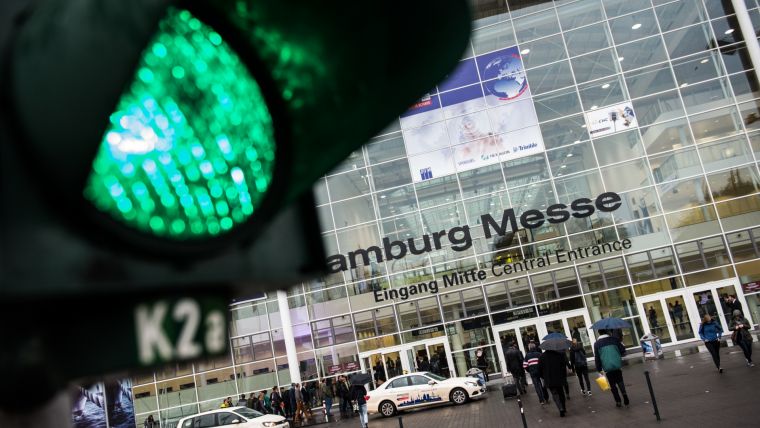
After notching up 531 exhibitors from 37 countries, more than 17,000 visitors from over 100 countries and an international Intergeo conference attended by 1,300 delegates, Intergeo – held in Hamburg from 11-13 October – has now drawn to a close. The sector’s dynamic momentum was keenly evident in packed exhibition halls and conference rooms, the young, international audience and three days full of information and discussion. Prof Hansjörg Kutterer, the newly elected president of Intergeo’s host organisation DVW, described Intergeo as being where the geo-IT sector meets its users. Intergeo is cross-industry dialogue at its very best, he said. It focuses on the resource of the future: smart geoinformation.
Trade fair exhibitors from all over the world have been showcasing their product innovations and intelligent solutions and services at Intergeo – covering the entire process chain from data collection and analysis through to presenting and displaying results. Intergeo was the highlight event of the year for manufacturers and service providers of GNSS surveying, mobile mapping, laser scanning and surveying, and inspection and monitoring with drones/UAS. Dr.-Ing. Christoph Fröhlich from Zoller+Fröhlich speaks for the majority of exhibitors with his verdict that Intergeo is the world’s absolute top event for our customers. They fly in from all over the world in order to meet us and check out the latest developments in the sector. Intergeo was also a resounding success for geoinformation system manufacturers and suppliers of geoinformation services.
Smart cities
At the heart of the exhibition themes and conference program stood cities as our habitat and working and economic environment. Keynote speaker Nigel Clifford, chief executive of British Ordnance Survey, used the case study of Manchester to show how geoinformation in the Internet of Things (IoT) will shape our urban surroundings. Ron Bisio, vice president geospatial at Trimble, crafted smart cities scenarios in his own keynote speech. Environmental pollution, energy consumption, effective transportation and traffic processes, civic dialogue and transparency, digital transformation in the health sector and culture – there is no sphere of life that will remain cordoned off from digitalisation. The seeds for our digital future are being sown right here and now.
The setting for the Smart City headline could not have been better. Hamburg’s strategy for digital development as a smart city paves the way forward. Its digital strategy is firmly anchored in the highest political ranks. This was confirmed by the attendance of Hamburg’s senator Dr Dorothee Stapelfeldt at Intergeo, where she scrutinised the wealth of smart city providers. This year also heralded the first dedicated Smart City SOLUTIONS platform.
BIM
The topic of Building Information Modelling (BIM) is also gaining considerable ground. BIM transfers the processes involved in planning, constructing and operating structures and infrastructure into the digital world. The same clear message rings out – BIM enjoys solid political support and is only a matter of time. The German Federal Ministry of Transport and Digital Infrastructure (BMVI) has set the schedule for introducing BIM as the standard method for infrastructure projects with its multi-tiered Digital Planning and Building plan. Industry and sector associations are pressing for rapid changes. Speakers from the planen-bauen 4.0 platform, the BMVI and the international Smart Building association along with industry representatives intensively debated developments towards transparent and internationally competitive construction processes in panel discussions and conference sessions during Intergeo. Everyone who took part agreed that the geoinformation that geodesists provide at the outset makes them crucial to BIM processes.
Geospatial 4.0
The concept of Geospatial 4.0, which has emerged in tandem with Industry 4.0, has really pushed to the fore. This year’s Intergeo showed not only that smart geoinformation and services have proved to be motors of innovation in the economy and administration, but also that more and more industries are basing their business models on the intelligent use of geoinformation. Correct and sustainable decisions depend on impeccably prepared information. The DVW’s President Kutterer emphasises that standardisation, licensing and pricing issues now need resolving in order to promote geoinformation as a lynchpin in business and administration. Dr Jürgen Dold, CEO of Leica Geosystems, is clear that the online environment is steadily becoming reality. With regard to the big data debate, he says: “Whatever the volume of data, the key lies in using it smartly.”
interaerial SOLUTIONS
The UAV sector is looking exceptionally dynamic. Interaerial SOLUTIONS, which was introduced as a free-standing platform at this year’s Intergeo, brought together over 130 exhibitors – from start-ups to global corporations – with their customers. Kay Wackwitz from market researchers Droneii.com deems Intergeo the ideal platform for the fledgling UAV sector: The market is absolutely exploding. More and more start-ups are jostling to find their own niche. Interaerial SOLUTIONS covers the sector’s entire spectrum. And Intergeo is the perfect medium for these companies to show off their skills – with the key applications still lying in surveying, inspection and monitoring of infrastructures and structures, Wackwitz said. Fields of application and upcoming trends were examined in forum presentations and panel discussions. Sector newcomer Intel chose the event to unveil its first ever drone – the Intel Falcon 8+. The sector is surging onward and upward, despite the remaining legal uncertainties. Interaerial SOLUTIONS hosted three days of debate on the future of drones as surveying and inspection devices, but also as the platform for aerial photography and even as a means of transportation.
Berlin
As one Intergeo closes, the next already looms on the horizon. The hosts and organisers are already gearing up for Berlin 2017. In the words of DVW President Kutterer: The dynamic momentum calls upon us to make next year’s event the ultimate stage once again for the geo IT sector to showcase itself to its users. The next Intergeo will be held at Messe Berlin from 26 to 28 September 2017.
Source: Intergeo.

Value staying current with geomatics?
Stay on the map with our expertly curated newsletters.
We provide educational insights, industry updates, and inspiring stories to help you learn, grow, and reach your full potential in your field. Don't miss out - subscribe today and ensure you're always informed, educated, and inspired.
Choose your newsletter(s)


