Klau Geomatics Launches GNSS and IMU Processing Solution for UAV Mapping
Is the market influx of cheap UAV hardware and software making it difficult for surveyors and engineers to produce quality mapping? Is the industry heading for a race to the bottom in what used to be a quality-focused profession?
Cheaper unmanned aerial vehicle (UAV or ‘drone’) hardware and software can seem like a good way of keeping initial costs down. However, recaptures, a heavy reliance on ground control points (GCPs) and processing workarounds all cost time and money too – not to mention the fact that lower accuracy, reliability and confidence in the outputs can affect the company’s productivity and, in some cases, its reputation.
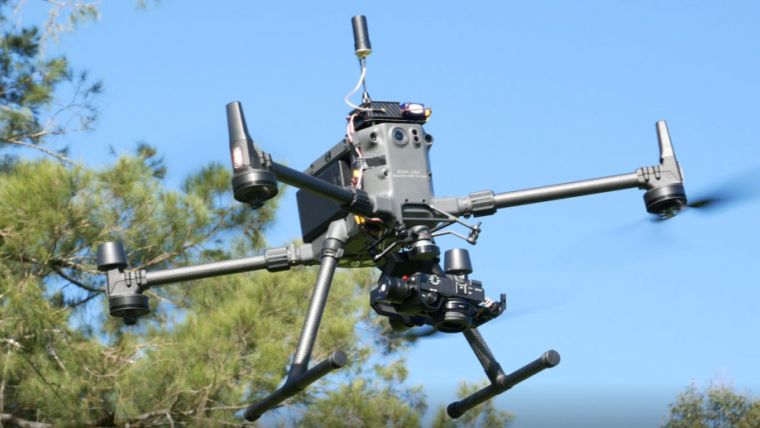
According to Klau Geomatics, its UAV software delivers the quality and sophistication that professionals need. Even in conjunction with cheaper hardware such as a DJI RTK drone, KlauPPK will produce the most robust, survey-grade positioning outcome possible, and the latest release adds even more survey-grade capabilities, the company claims.
Cloud Processing Engine
Following on from RTK and PPK, now there’s MakeItAccurate (MIA). KlauPPK desktop software has direct integration with MakeItAccurate to run drone data through a sophisticated cloud processing engine that applies satellite clock and orbit corrections and ground reference data to produce highly accurate camera positions. Customers find that MIA can save the day in the case of poor-quality or unavailable drone data or base station data. Large enterprise drone operations no longer need base stations, CORS access, placing GCPs and so on; they can just fly the drone.
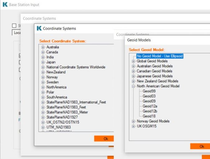
Coordinate Systems
Coordinates can be exported in any of the hundreds of supported coordinate systems in the KlauPPK software. It is not only possible to write WGS84 to EXIF, but also to obtain the State Plane coordinates that match client requirements in metres, feet or international feet – it’s all there, along with systems for most countries of the world.
If the site is on a Local Coordinate System, XYZ aligned to the project, the camera coordinates can be transformed to suit.
Height Datum
When it comes to heights, geoids bridge the gap between real-world in physics and geometry. The height datum in any part of the world can be modelled and represented by at least one geoid model. KlauPPK software has 23 geoids to produce heights that are corrected to match the real-world heights of the survey area.
Whether for engineers looking to get survey-grade results from a drone, whether no base station data is available, or whether for an enterprise drone fleet looking to reduce complexity, the Klau Geomatics software solutions are developed with the aim to improve the quality and efficiency for businesses.

Value staying current with geomatics?
Stay on the map with our expertly curated newsletters.
We provide educational insights, industry updates, and inspiring stories to help you learn, grow, and reach your full potential in your field. Don't miss out - subscribe today and ensure you're always informed, educated, and inspired.
Choose your newsletter(s)


