Land-cover Maps of Europe from the Cloud
Earth’s land is covered by a range of different types of vegetation, from forests and marshes to crops and bodies of water, as well as the artificial surfaces that are an increasingly common feature of the landscape. Mapping land cover is not only essential for monitoring change, but it also underpins numerous practical applications. However, generating these maps entails handling huge amounts of satellite data and some technical expertise. Thanks to the Copernicus Sentinel-2 mission and new cloud-computing resources, fully automated land-cover maps in 10m resolution are on the horizon.
Natural processes, climate change and the way we use land to feed, shelter and support a growing population means that Earth’s land cover is in a continual state of change.
Information on land cover is important at many levels – at local, regional, national and global scales, and over different timescales.
Up-to-date maps are a basic source of information to track the impact that human activity, natural processes and climate change have on land cover. These maps are critical for making informed policy, development and resource management decisions, and for disciplines such as agriculture, forestry, water management, urban planning, environmental protection and crisis management.
Multispectral imaging
Orbiting almost 800km above, the two-satellite Copernicus Sentinel-2 mission is on hand to map land cover in 10m resolution.
Each identical satellite carries a multispectral imager that can distinguish between different classes of cover such as forest, cultivated areas, grassland, water and artificial surfaces like roads and buildings. The mission can also be used to determine plant indices such as the amount of chlorophyll and water in leaves so that changes in plant health and growth can be monitored.
While Sentinel-2 delivers ideal images to map land cover, producing global maps, or even maps of one country, means that huge amounts of time-series data have to be processed. To make this possible, the ESA-funded Sentinel-2 for Science Land Cover project explored novel ways of capitalising on the latest cloud-computing technologies and machine learning to automate mapping.
Through this experiment, different methodologies were explored and tested over different areas of the world, including the full European region.
Classification methodology
The scientists used dedicated software developed by the Space Research Centre of the Polish Academy of Sciences, CBK PAN, to process the satellite images and auxiliary data.
Stanislaw Lewinski, from CBK PAN, said: “Indeed mapping land cover is a real technical undertaking, but thanks to funding from ESA we have developed a classification methodology that is mainly automated to make land-cover mapping easier. Our system is based on Copernicus Sentinel-2 imagery where each image tile has been classified separately using a set of images from different times, and we chose a pixel-based approach to maintain the mission’s 10 m resolution."
“Importantly, it also involved many tests in selected areas across Europe. The final maps have been produced on a platform called CREODIAS with the algorithms and software that we developed.”
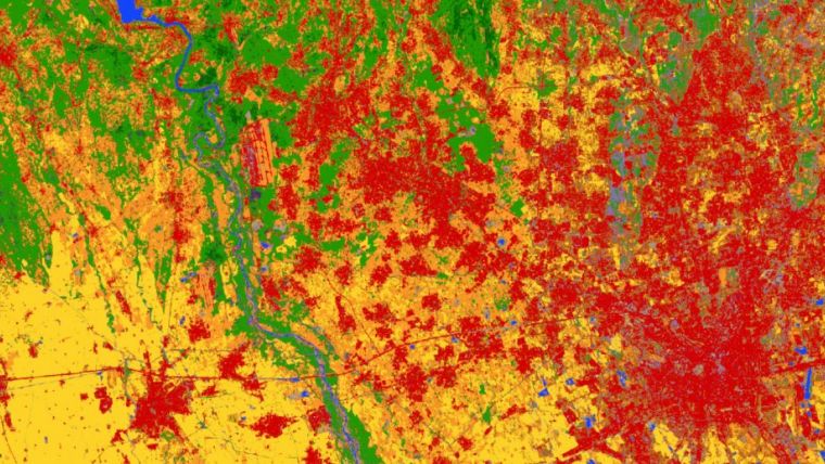
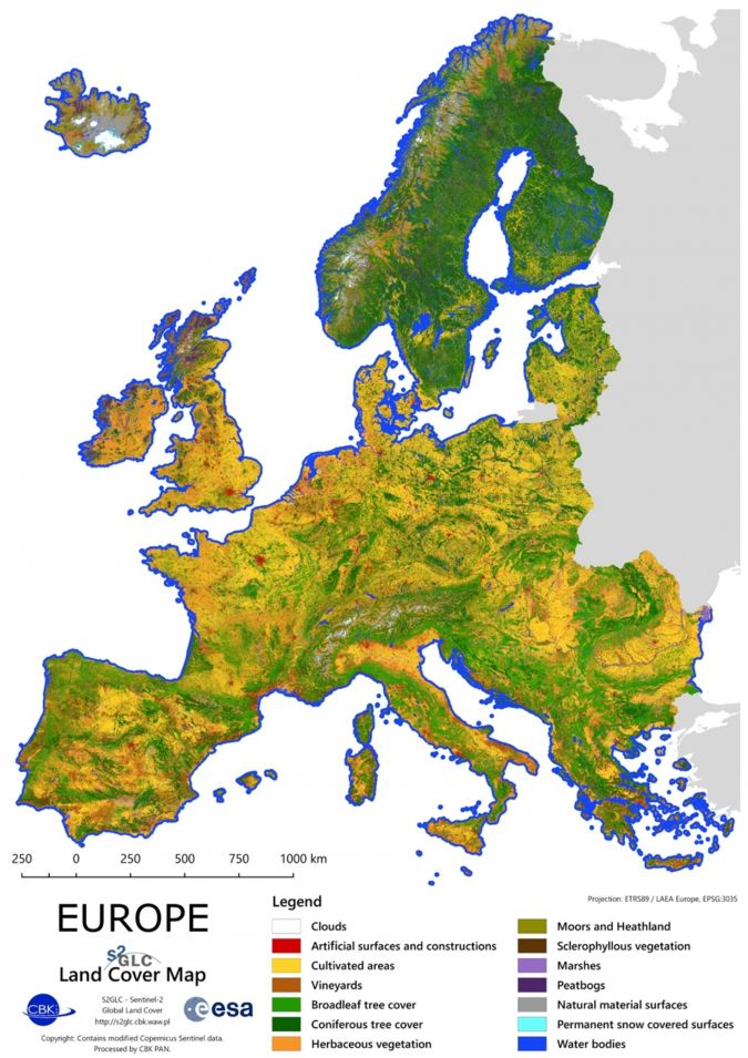
CREODIAS is a large-scale computing and data storage platform that enables processing and publication of results of large-scale data analysis activities. The result is a map of Europe at 10 m resolution displaying 13 land-cover classes.
ESA’s Espen Volden noted: “While we are still in the experimental stage and some land-cover classes don’t reach an accuracy that can be exploited directly and there are some other artefacts, the results are very promising. We demonstrate that fully-automated mapping is on the horizon, opening the way to much more frequently updated land-cover information than has been possible so far.”
Viewing and download
The map of Europe at 10 m resolution displaying 13 land-cover classes can be viewed in full resolution on the CREOSIAS EO Browser (select S2GLC and click search), or accessed as a WMS layer for expert use.
All classified Sentinel-2 tiles can be downloaded from the CREODIAS finder.
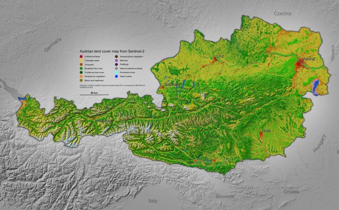
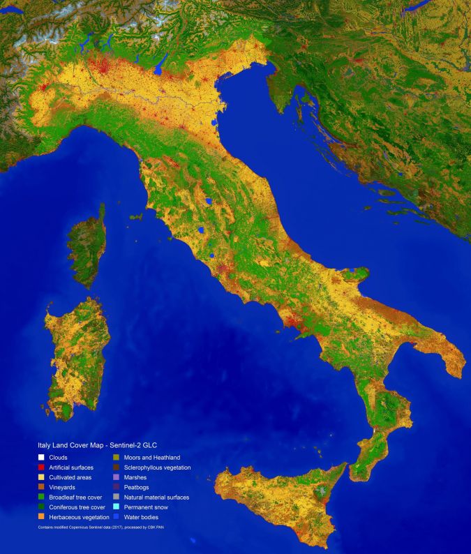
Download the full-resolution mosaic (see data access), or as reduced-resolution country maps of 35 European countries.
Source: ESA.

Value staying current with geomatics?
Stay on the map with our expertly curated newsletters.
We provide educational insights, industry updates, and inspiring stories to help you learn, grow, and reach your full potential in your field. Don't miss out - subscribe today and ensure you're always informed, educated, and inspired.
Choose your newsletter(s)


