Leica Cyclone v7.1 Software
The new Leica Cyclone v7.1, a significant advance in Leica Geosystems Cyclone point cloud software, speeds these key office steps: (1) accurately registering multiple scans together and (2) navigating to and clearly visualizing specific areas of interest.
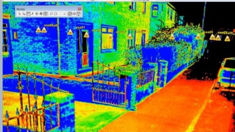
| Using the new local seek mode users can see the data near the viewer is extremely dense, even looking solid while farther away the points are not shown at all. |
A new registration option lets users automatically register scans together via inexpensive black-and-white paper targets, without the need to label scan targets. This not only eliminates any need to use uniquely labeled scan targets, but it also eliminates a time-consuming and often error-prone office process of reading target labels from scan data, manually typing these labels into the registration software, and then searching for and fixing any labeling errors. By using this new "position-based" target registration instead of label-based registration, users can achieve tighter registrations, faster.
Moreover, unlike methods that require the use of uniquely labeled targets throughout an entire project, Cyclone 7.1 lets you freely re-use black-and-white paper targets (labeled or unlabeled) on a project. Such targets are especially popular with phase-based scanning (Leica HDS4500 and HDS6x00 scanners), which often involves heavy usage of targets.
When High-Definition Survey scan data of complex plants, buildings and ships are displayed on a computer screen, it can be difficult to clearly find and discern local areas of specific interest. Displayed points can include extra scan points far away from a local area of interest, thus confusing the viewer. An efficient, new "Local Seek" viewing mode in Cyclone 7.1 overcomes this problem.
The new viewing mode enables a user to see only scan points within close proximity of any chosen scan point. This makes it easier to browse through large point clouds and find local areas of interest. Once there, points are automatically displayed at higher density, thus also making it easier to discern features of interest. This new viewing capability is based on Cyclone 7.1's point cloud Engine (pcE) that better organizes scan data for such tasks.
Cyclone 7.1 also:
- supports registered scan data sets from ScanStation C10 that have been automatically registered in the field using C10 firmware v2.0's "Known-point setup" and "Backsighting" capabilities
- directly supports pcE data formats in the Cyclone SERVER module
- features certification of all Cyclone products for use with Microsoft Windows 7
- allows direct data export from Cyclone to Leica CloudWorx-VR for 3D Studio Max, etc.
Cyclone 7.1 software is immediately available for all customers with valid maintenance contracts.

Value staying current with geomatics?
Stay on the map with our expertly curated newsletters.
We provide educational insights, industry updates, and inspiring stories to help you learn, grow, and reach your full potential in your field. Don't miss out - subscribe today and ensure you're always informed, educated, and inspired.
Choose your newsletter(s)


