Leica Geosystems Launches Entry-level Laser Scanner
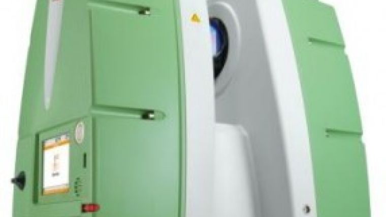
Leica Geosystems has announced the launch of its latest 3D laser scanner, the ScanStation P15. The new scanner is designed to complement existing scanning products with its high-quality, short-range function. In order to achieve the advanced functionality of the ScanStation P20, upgrades will be made available in authorised Leica Geosystems technical service centres.
Suitable for a wide range of non-surveying applications including interior and short-range uses, the latest model offers a simplified user interface and optimised workflow, with no prior surveying knowledge or training required for operation. The ScanStation P15 is suitable for a range of environmental conditions and delivers high-quality data fast.
Based on the advanced ScanStation P20, Leica Geosystems’ ScanStation P15 offers the same 3D scanning technology with high measurement speed and accuracy up to 40 metres at an optimised price point. The ScanStation P15 can capture entire scenes within minutes and create highly detailed scans with overlaid images of the real 3D world bringing added value to end users.
Jürgen Mayer, HDS programme director at Leica Geosystems, said the perceived complexity of scanning has been a barrier to customers looking for an easy route into the 3D world. The new Leica ScanStation P15 is designed to be an accessible, trusted entry-level product, combining quality with simplicity, and no specialist surveying knowledge necessary.
For more information on the new Leica ScanStation P15 3D laser scanner see here.

Value staying current with geomatics?
Stay on the map with our expertly curated newsletters.
We provide educational insights, industry updates, and inspiring stories to help you learn, grow, and reach your full potential in your field. Don't miss out - subscribe today and ensure you're always informed, educated, and inspired.
Choose your newsletter(s)


