Leica Geosystems Launches Imagery and Live Video Stream for Monitoring
Leica Geosystems has unveiled Leica GeoMoS Imaging, a monitoring technology that provides visual information for site documentation, inspection and detection from remote access. With GeoMoS Imaging, an image-based extension to the existing GeoMoS monitoring solution, users can continuously stay up to date on their monitoring project, allowing them to make the best decisions.
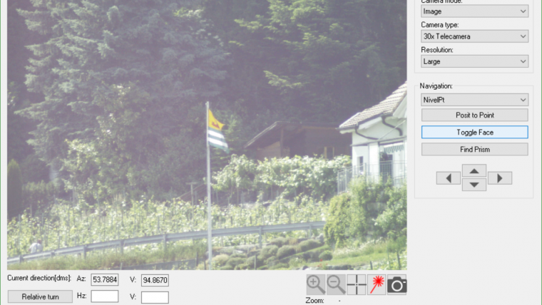
The remote monitoring of a site can now become simpler; the live view enables users to observe and record areas of interest, and the joystick functionality allows direct access to the total station and remote operation from the convenience of the desk. Professionals can now increase their productivity and reduce their time in the field.
Matthias Gropp, associate director at Murphy Surveys, said his team looks forward to expanding its solutions portfolio with Leica GeoMoS Imaging, a newer technology that allows to provide cutting edge services to customers. The live video stream from the field and automatic site visual documentation will reduce time on site and make monitoring simpler. GeoMoS Imaging opens up new opportunities for the business to accelerate growth, Gropp said.
Real-time solution
GeoMoS Imaging allows automated visual inspection, enables remote observation of the site and maximises user’s output. With the live stream camera and the availability of repeated recorded images, users can obtain a better understanding around the project. For example, they can evaluate the progress of a construction or excavation site to make informed decisions about work schedules.
An automatic monitoring cycle keeps track and combines all monitoring data with images. Professionals can export, in seconds, detailed reports to observe changes of a natural target and aging infrastructure that allow for better planning.
Faster and safer
For large or small scale projects where environmental monitoring is key for safety, GeoMoS Imaging provides a flexible and expandable solution designed to assess and take protective measures in harsh and hazardous conditions. In emergency situations, quick evaluations can be made to prevent further damage and keep communities safe.
Users can evaluate and take these swift actions by visualising obstructions in line of site and providing information on metadata. Monitoring professionals can also achieve fewer site visits, keeping staff out of harm’s way while reducing costs.
Leica Geosystems will be the first to introduce to the market live video stream from the field, a feature that increases monitoring operator’s productivity by allowing them to monitor the site from their office, said Michael Rutschmann, Leica Geosystems product manager. Monitoring service providers, and mining and construction professionals can now invest in innovative technology that enables them to observe details with high resolution in dynamic project environments.
To learn more about the Leica GeoMoS Imaging, see here.

Value staying current with geomatics?
Stay on the map with our expertly curated newsletters.
We provide educational insights, industry updates, and inspiring stories to help you learn, grow, and reach your full potential in your field. Don't miss out - subscribe today and ensure you're always informed, educated, and inspired.
Choose your newsletter(s)


