Leica Geosystems Launches Laser Scanners and Point Cloud Software
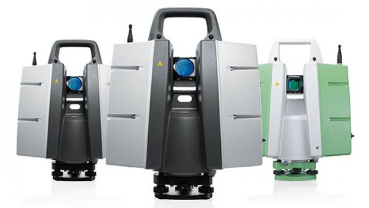
Leica Geosystems has announced a group of six major new products for terrestrial laser scanning: three new laser scanners and three new point cloud software products. Leica ScanStations P40, P30, and P16 feature advances in Lidar and digital imaging as the 8th generation of Leica Geosystems laser scanners.
The new scanners are designed to increase field and office productivity and simultaneously offer sharper, crisper scans and HDR true colour images. Users will be able to capture more, useful data from a single set-up, which translates into fewer instrument setups and greater productivity, according to the Swiss company. Three models meet different user needs: the Leica ScanStation P40 and P30 add survey functionality, longer range capabilities (to 270m for P40), and advanced scanner controls for additional versatility and productivity while the Leica ScanStation P16 is a short range, introductory model.
Point cloud solutions
In addition to the new software releases Leica JetStream and TruView Global products, Leica Geosystems announces Leica CloudWorx for Navisworks – a popular design review application from Autodesk – as its newest family member of CloudWorx plug-ins for CAD and VR applications. JetStream is a combined project data vault and high-performance data streaming server that takes Cyclone data and serves it up in a high-performance format that enables a CloudWorx user more productive when working with point clouds, Leica Geosystems states. Much of that gain comes from instantaneous loading and navigation of point clouds – eliminating traditional “waiting times” long associated with point cloud office work. Lastly, TruView Global increases anyone’s access to TruViews – Leica Geosystems’ application for viewing and measuring scans. TruViews will be accessible within any internet browser on any mobile device or computer, with no App or plug-in to install.

Value staying current with geomatics?
Stay on the map with our expertly curated newsletters.
We provide educational insights, industry updates, and inspiring stories to help you learn, grow, and reach your full potential in your field. Don't miss out - subscribe today and ensure you're always informed, educated, and inspired.
Choose your newsletter(s)


