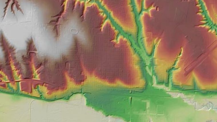
LiDAR Data for Rainwater Basin Project
Merrick & Company working for Optimal Geomatics under a contract with the US Army Corps of Engineers is collecting light detection and ranging (LiDAR) data over a 17,677-square-mile area in order to create a digital elevation model. The digital elevation model will be used in natural resources, agricultural planning and management, and to update the flood maps in the area.
More specifically, it will serve as part of the wetland restoration index, a tool that is being used to prioritize habitat protection and restoration activities to achieve the greatest wetland biological return for the habitat investment dollar and for stream restoration on the Platte River as part of the Platte River Recovery Implementation Program. The project area covers almost all of south central Nebraska and four counties in north central Kansas.
The Rainwater Basin project involves multiple agencies including the Rainwater Basin Joint Venture. This joint venture was formed in 1992 to address the problem of declining migratory waterfowl habitat. The Venture's goal is to restore and permanently protect 37,000 acres of high-quality wetlands and 25,000 acres of associated uplands with adequate water and distribution to meet the habitat needs of waterfowl and other migratory birds. The organisation also provides the structure by which multiple agencies can work together to address natural resource issues through projects that also improve migratory bird habitat. Through that organizational structure, this project also involves the US Department of Agriculture Natural Resources Conservation Service, US Fish and Wildlife Service; the US Geological Survey, Platte River Recovery Implementation Program, the states of Nebraska and Kansas, and numerous local entities.
The LiDAR information being collected includes hydrologic modifications that impair a wetlands ability to function; delineation of wetland watersheds, which due to the low relief in most of the project area, can only be identified using LiDAR technology; soils mapping; elevation data that will help in planning and designing terraces, buffers along streams, and stream restoration to help reduce water pollution and maintain the land's sustainability; and dam breach analysis to model the effects of dam breaches and the areas that would be flooded if that were to occur.

Value staying current with geomatics?
Stay on the map with our expertly curated newsletters.
We provide educational insights, industry updates, and inspiring stories to help you learn, grow, and reach your full potential in your field. Don't miss out - subscribe today and ensure you're always informed, educated, and inspired.
Choose your newsletter(s)


