Lidar in a Backpack: Scanning a Whole Stadium in Just a Few Minutes
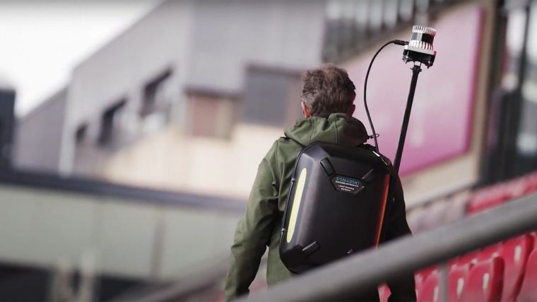
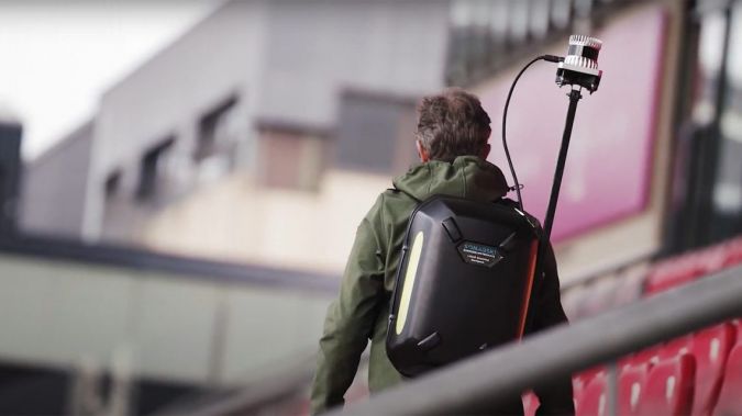
Startup Sonarski’s Lidar backpack has been used to digitally map Galgenwaard Stadium, home to the Dutch football club FC Utrecht. Read on for more details of this time-saving and convenient digital mapping solution.
As GIM International readers know, Lidar technology uses laser pulses to determine the distance to an object or surface. This method offers countless possibilities in geomatics as it enables the rapid creation of digital 3D models of large-scale structures – such as stadiums, as demonstrated in the Galgenwaard Stadium project. Work that would normally take weeks can now be completed in as little as five minutes; just one walk through the stadium results in a comprehensive digital representation of the surroundings in 3D, capturing detailed information efficiently and overlooking nothing. André Kapitein, CEO/CTO of Sonarski, demonstrates the solution and explains more in this video (in Dutch only).
Digitizing complete environments with Lidar
Sonarski, a startup from the Dutch city of Haarlem, can scan environments and assets in 3D using various methods and technologies. The company has designed its own hardware, which is compact enough to fit into a backpack. Sonarski has also developed its own SLAM algorithm that enables the laser scans to be converted into highly accurate 3D models which can be used for a wide range of applications. One key benefit of the Lidar backpack is that it’s a very manoeuvrable mobile solution that is much more convenient than stationary systems. As a result, the backpack can be utilized to survey existing buildings or terrains as well as during renovation projects or for the precise positioning of machines or objects. Moreover, Lidar is suitable for use in security-related applications, thanks to making security systems more accurate, reliable and cost-efficient. Additionally, it is increasingly widespread in serious gaming, since the captured 3D objects provide detailed AR experiences.
How 5G is perfecting the use of Lidar
After the environment has been scanned, the render server uses the 3D point cloud to create a 3D model with millimetre accuracy. The adoption of 5G as a standard wireless broadband network technology further increases Lidar’s potential since it supports lightning-fast data processing, so the resulting model can now be displayed on a computer within a matter of seconds. In the case of Galgenwaard Stadium, the model can then be used for monitoring purposes, to analyse the emergency exits or routes through the stadium, to check for signs of sloping or sagging in the roof, or to assess opportunities for renovation or expansion.
Lidar is becoming increasingly mainstream, as demonstrated by the fact that the newest generations of iPhone and iPad have a built-in Lidar scanner. And for professionals, portable and wearable solutions like Sonarski’s ‘Lidar in a backpack’ are making digital mapping of the environment a lot easier, faster and more affordable.
The FC Utrecht football stadium was scanned in a matter of minutes and processed into a detailed 3D model, which became digitally available and shareable almost immediately.

Value staying current with geomatics?
Stay on the map with our expertly curated newsletters.
We provide educational insights, industry updates, and inspiring stories to help you learn, grow, and reach your full potential in your field. Don't miss out - subscribe today and ensure you're always informed, educated, and inspired.
Choose your newsletter(s)


