Longer-Range Airborne Laser Scanning System
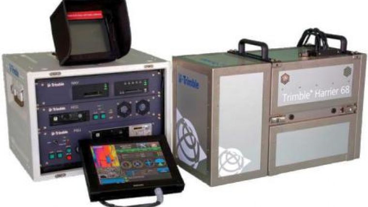
Trimble has added the Trimble Harrier 68i to its aerial imaging and laser scanning systems. Designed for aircraft and helicopter operation, the new version is suited for long-range corridor, project, and wide-area mapping. Based on the Trimble Harrier 68, laser scanner extends the typical operating altitude to 1,600 meters above ground level.
The system incorporates a wide-angle laser scanner with a 266KHz effective measurement rate to deliver high point density on the ground, providing the detailed modeling data needed for precise planning, engineering, and monitoring applications.
The Trimble Harrier 68i includes:
•LMS-Q680i airborne laser scanner
•Trimble Aerial Camera-a 60 megapixel metric camera
•Applanix POSTrackTM system providing GNSS-aided inertial direct georeferencing and advanced flight management
•Easy-to-use operator and pilot displays with real-time monitoring of system status, imagery, and laser scanner data
•Computer
•Data storage and backup system
•Pilot-only operation (optional)

Value staying current with geomatics?
Stay on the map with our expertly curated newsletters.
We provide educational insights, industry updates, and inspiring stories to help you learn, grow, and reach your full potential in your field. Don't miss out - subscribe today and ensure you're always informed, educated, and inspired.
Choose your newsletter(s)


