Malaysian Remote Sensing Agency Signs RADARSAT-2 Deal
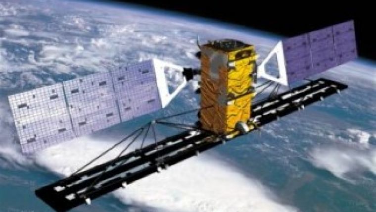
MDA’s Information Systems group has signed a contract with the Malaysian Remote Sensing Agency (MRSA) to provide RADARSAT-2 information that will be used to support a number of applications, such as agriculture monitoring and natural disaster response. MRSA has been using RADARSAT information to support various applications since 2003.
MRSA has been utilising the recent access to RADARSAT-2 information to aid in the search of the missing Malaysia Airlines Flight MH370.
The RADARSAT-2 satellite has global high-resolution surveillance capabilities that include a large collection capacity, high accuracy and wide-area coverage that is extremely useful in imaging the vast tracts of territory. The satellite acquires data regardless of light or weather condition, provides frequent re-visit imaging options, and is supported by ground receiving stations that provide near real-time information delivery services. This versatility makes RADARSAT-2 a reliable source of information in multi-faceted intelligence surveying and monitoring programmes.

Value staying current with geomatics?
Stay on the map with our expertly curated newsletters.
We provide educational insights, industry updates, and inspiring stories to help you learn, grow, and reach your full potential in your field. Don't miss out - subscribe today and ensure you're always informed, educated, and inspired.
Choose your newsletter(s)


