Maxar unveils 3D digital twin for VR and simulation
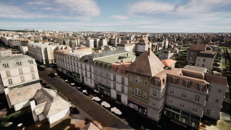
Maxar Technologies and blackshark.ai have collaborated to develop SYNTH3D, a synthetic 3D digital twin of the Earth's surface that is highly compatible and visually pleasing for use in gaming, simulation, entertainment, virtual reality (VR), smart city and metaverse applications.
This high-performance 3D model, created using blackshark.ai's patented generative artificial intelligence (AI) technology and Maxar's Vivid imagery basemap, is procedurally generated with geotypical textures to replicate the architectural style of a given region, offering a lifelike model.
SYNTH3D offers developers and creators a comprehensive solution to simulate and visualize 3D environments representative of real-world locations. The model has been designed to be highly compatible and visually pleasing while accurately representing the geographic and building features of a specific area. Ideal for commercial and government applications where aesthetics and performance are key, the digital twin solution will revolutionize how various industries build and interact with VR environments.
Geotypical 3D model of planet Earth
The potential applications are broad, said Dan Nord, Maxar's senior vice president and general manager of Enterprise Earth Intelligence. “This lightweight digital twin will be useful in scenarios such as when developers are creating the next-generation video games, producers are working on upcoming films, and governments and businesses are assembling simulation environments; the opportunities are limited only by the imagination.” SYNTH3D is complemented by Precision3D, another 3D digital twin in Maxar's product portfolio, which offers highly accurate visualization with precise details and geospecific building heights and facades.
In summary, the solution can best be described as a region-specific, geotypical 3D model of the planet's surface, ideal for a broad range of geospatial training, simulation and visualization applications, with endless possibilities for developers, creators and businesses alike. Offering high performance, accuracy and stunning visuals, SYNTH3D and Precision3D are ushering in a new era of 3D geospatial solutions, empowering users to explore and harness the full potential of a synthetic digital twin of the planet.

Value staying current with geomatics?
Stay on the map with our expertly curated newsletters.
We provide educational insights, industry updates, and inspiring stories to help you learn, grow, and reach your full potential in your field. Don't miss out - subscribe today and ensure you're always informed, educated, and inspired.
Choose your newsletter(s)


