Measuring Safety Barrier Heights on European Roads
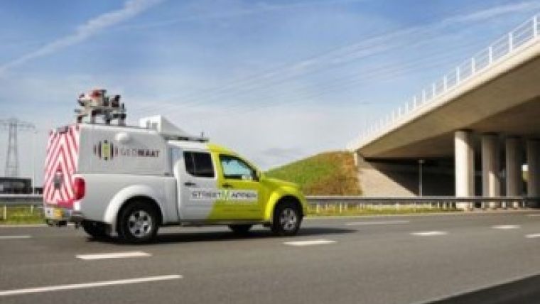
Geomaat, a Dutch company specialised in geodetic survey services, has developed a method of measuring safety barrier heights on European roads. The system uses StreetMapper, 3D Laser Mapping’s mobile laser mapping system, and automated feature extraction software. This combination makes it possible to process laser scanned point clouds to determine the height of existing barriers.
After determination of the barrier height, the software automatically codes the georeferenced 3D model: green for acceptable and red for requiring attention.
Geomaat is also exploring the use of StreetMapper data to identify and record the locations of the miniscule detection wires located along highways. Used to record traffic volumes, speeds and temperatures, for example, these provide essential intelligence for highway managers. In a similar development, Geomaat is using the same point cloud data to calculate clearances and free heights along highways prior to extensive resurfacing projects.
Jolle Jelle de Vries, managing director of Geomaat, said the fundamental difference of using StreetMapper versus traditional surveying techniques for highway surveys, is that with StreetMapper one can - and does - measure everything quickly and with minimal disruption to other road users. That means that when additional questions arise during the course of the project, you already have the answers, he added.
In addition to the highly accurate point cloud measurements, StreetMapper also enables capture of 360-degree georeferenced images, which allow us to visualise the DTM, design, barriers, etc, in a real-world context, De Vries continued.
These developments are the result of extensive survey projects in the southern part of The Netherlands. Working on behalf of many of the civil construction companies who have been awarded highway maintenance projects by the Dutch Road Administration, Geomaat has surveyed more than 400 kilometres of road. Using StreetMapper, Geomaat was able to complete the data capture element of the project within just four days, and within four weeks it had produced a DTM and complete pavement design with milling and asphalt figures. This compares to a project length in excess of 3 months for more traditional data capture and processing methodologies.
StreetMapper has been specifically designed for the rapid 3D mapping of highways, runways, railways, infrastructure and buildings. Using vehicle-mounted lasers offering a 360-degree field of view, StreetMapper enables high-precision mapping to a range of 300 metres, a capacity of 550,000 measurements per second per sensor, and recorded accuracies in independent real-world projects of better than 10 millimetres.

Value staying current with geomatics?
Stay on the map with our expertly curated newsletters.
We provide educational insights, industry updates, and inspiring stories to help you learn, grow, and reach your full potential in your field. Don't miss out - subscribe today and ensure you're always informed, educated, and inspired.
Choose your newsletter(s)


