Mining Consultants Add Lidar Mapping Solution to Toolkit
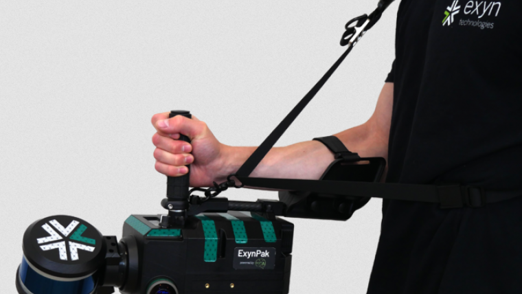
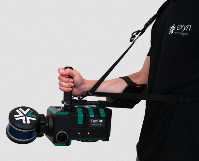
Burgex Mining Consultants has announced newly acquired in-house capabilities to provide high-accuracy mapping of surface and underground mine workings with the addition of the ExynPak from Exyn Technologies to its fleet of advanced mining and mineral exploration solutions.
With a gimballed Velodyne Lidar sensor and the ability to provide real-time 3D mapping with survey-grade accuracy, the ExynPak is an innovator in high-accuracy handheld mapping for mining and exploration applications. Simultaneous localization and mapping (SLAM) provides accurate, survey-grade 3D mapping in real time without the use of GPS. This delivers precision mapping in underground mining environments that have been traditionally difficult to map using modern methods.
Identifying slopes and faults in real time
The ability to map underground and surface mining workings in high resolution provides an enormous advantage to mine planning and mineral exploration projects. With Lidar capabilities of over 600K points per second and a 360° horizontal field of view, it is possible to quickly identify slopes, faults, and other geological features in real time. In addition to generating <3cm accuracy point clouds in real time, the ExynPak is also equipped with two FLIR Chameleon3 RGB cameras that are capable of colorizing points – providing yet another layer of functionality to geologic mapping and mine planning projects.
Underground and surface mapping
Leveraging portable Lidar with aerial data collection provides a new level of flexibility in modelling for mining and mineral exploration projects that is not offered at many other mining consulting firms in the United States. Combined with aerial mapping, the Burgex team can pin underground and surface Lidar surveys to geo-referenced base surveys and maps – creating a completely modeled project that can be used for mine planning, exploration programs, and more. Additionally, Burgex Mining Consultants has recently added a DJI Matrice 300 RTK (M300) to its fleet of UAVs, providing greater capabilities for aerial data collection. Not only can the M300 collect data more efficiently that other UAVs, but it can also simultaneously carry up to three payload sensors. The M300 has a max transmission range of up to 9.3 miles with a 55-minute maximum flight time. The IP45 water and dust protection ratings and expanded operating temperatures will enable operation in a broader range of field conditions.
Stuart Burgess, CEO and co-founder of Burgex, stated: “We are very excited about the addition of this new equipment and the new services we will be able to provide for our clients. From underground to surface, we’ll be able to map and model projects quickly and with centimeter accuracy, which is something that used to be very difficult and expensive to achieve, especially in underground environments. These new tools represent the next generation of mining and mineral exploration advancements.”

Value staying current with geomatics?
Stay on the map with our expertly curated newsletters.
We provide educational insights, industry updates, and inspiring stories to help you learn, grow, and reach your full potential in your field. Don't miss out - subscribe today and ensure you're always informed, educated, and inspired.
Choose your newsletter(s)


