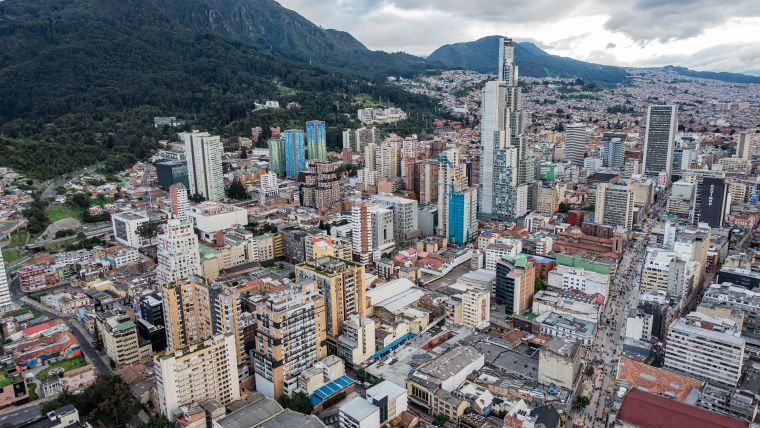
Mobile and Aerial Mapping to Protect Bogotá Residents
The Capital District of Bogotá, Colombia, is using artificial intelligence to analyse images collected through terrestrial and aerial mapping. By identifying homes and neighbourhoods that need to be improved, the goal is to have families living in better, greener, safer homes before the next disaster strikes.
This effort, supported by the World Bank’s Global Program for Resilient Housing (GPRH), uses a Trimble MX7 vehicle-mounted mobile-mapping system to capture street-level imagery across neighbourhoods and combine it with aerial imagery collected by unmanned aerial vehicles (UAVs or 'drones'). Bogota then uses machine learning algorithms to identify buildings and urban areas that could benefit from upgrading and an inspection by an engineer.
As Nadya Rangel, Secretary of Habitat of Bogota, points out: “This technology will help the city plan and implement future housing and urban upgrading investments in the most vulnerable areas.”
Making visible the invisible
The technology is making vulnerable areas more visible to decision-makers who determine public and private investment in housing and urban infrastructure. “Just as technology can help to detect cancer and provide treatment that we did not think was possible, governments can use technology to triage the homes and neighbourhoods that could benefit from immediate upgrading interventions, said Luis Triveño, senior urban development specialist and lead of GPRH.
The idea of imaging neighbourhoods to locate homes that are more vulnerable to earthquakes was sparked by the problem of soft-story buildings, said Sarah Elizabeth Antos, a data scientist and co-lead of GPRH.
A "soft story" is a structure in which one or more floors have windows, wide doors, and/or large unobstructed commercial spaces, or other openings where a shear wall would normally be required for stability against earthquakes. History shows that soft-story structures are prone to collapse during earthquakes and that seismic retrofitting is cost-effective.
The risk of soft-story buildings was made evident in Mexico on 19 September 2017, when a 7.1 magnitude earthquake caused more than 40 buildings to collapse, including the Enrique Rébsamen school, where 19 children and seven adults perished.
“It was very apparent from the street view imagery that this building was a soft story. Looking at street view imagery and talking to engineers, it was clear it was a seismically vulnerable structure,” Antos said.
The World Bank GPRH team started to wonder: Could they use machine learning – computer algorithms that learn and adapt – to mimic an expert’s eye? Could they detect not just school buildings, but also types of homes that might be vulnerable to seismic activity, so that engineers could be sent to conduct further assessments and governments can help retrofit them?
Source: World Bank.

Value staying current with geomatics?
Stay on the map with our expertly curated newsletters.
We provide educational insights, industry updates, and inspiring stories to help you learn, grow, and reach your full potential in your field. Don't miss out - subscribe today and ensure you're always informed, educated, and inspired.
Choose your newsletter(s)


