Modern Laser Scanner Helps UK Police
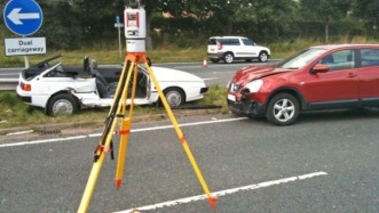
A modern laser scanner is helping the UK's North Yorkshire Police open the county’s roads faster following serious collisions, thus minimising congestion and therefore disruption to other road users. The RIEGL VZ-400, purchased from 3D Laser Mapping, is being used to record essential evidence at the scene.
This vital data is used by Collision Investigators to produce a virtual 3D reconstruction of the site, including high-quality graphics and detailed plans, for use in subsequent enquiries and court cases.
Dave Foster, senior collision investigator for North Yorkshire Police, said there are always two aspects of every collision: the scene itself and the detail of the collision including key evidence such as gouge marks, tyre scuffs, scratches, scrapes, debris and of course vehicle position. By using the VZ-400, purchased from 3D Laser Mapping, North Yorkshire Police has experienced at-scene time savings of around 40-50 minutes.
Foster said his police force is also achieving efficiency gains in the back office when analysing the scanned data. Despite collecting millions of individual measurements, they can easily create line-of-sight models and ‘move’ the vehicles to model different elements and aspects of the collision, Foster continued.
North Yorkshire Police purchased the 3D scanner after it had received funding by the Department of Transport, together with National Policing Improvement Agency (NPIA) contributions. Since taking delivery of the VZ-400 from 3D Laser Mapping the device has been regularly deployed on the county’s roads. Examples of scenarios where the scanner has been used include a collision between two motorcycles and a car near Tadcaster where the collision scene was over 150 metres with multiple approaches and a head on collision on a rural road. The VZ-400 has also been deployed on the County’s Strategic Road Network with detailed site surveys completed in record time.
"The objective nature of the scanned data means we capture every detail of the collision scene whether it appears relevant at the time or not," Foster stated. This means North Yorkshire Police can replicate impact positions, ‘virtually’ moving the vehicles in the digital model. It is also possible to interrogate the data to get a better understanding of driver’s views, both of the scene and of the other vehicles, at varying stages in the run up to impact.
The VZ-400 from 3D Laser Mapping was the product of choice of 14 out of 22 Police Forces awarded funding, ordering a total of 26 RIEGL laser scanners. The devices have now all been delivered to the respective forces supported by a comprehensive training programme.

Value staying current with geomatics?
Stay on the map with our expertly curated newsletters.
We provide educational insights, industry updates, and inspiring stories to help you learn, grow, and reach your full potential in your field. Don't miss out - subscribe today and ensure you're always informed, educated, and inspired.
Choose your newsletter(s)


