Monitoring Mountain Glaciers with TanDEM-X Radar Satellites
It is important to keep a watchful eye on glacial melt to avoid the sudden collapse of glaciers leading to tragedy, such as happened at the Marmolada glacier in the Italian Dolomites in July 2022. Besides that, ice melting from mountain glaciers is one of the largest contributors to sea-level rise outside the large ice sheets of Antarctica and Greenland. As well as this detrimental trend, the loss of glacier ice jeopardizes irrigation, hydro power, tourism and drinking water.
New research leveraging the vast data from the TanDEM-X mission has successfully mapped glacial elevation change over multiple mountainous regions of the world.
Interferometric Synthetic Aperture Radar
The monitoring of mountain glaciers is hampered by their considerable number and remote locations. Researchers based at the Friedrich-Alexander Universität (FAU), in Germany, recently derived surface elevation change rates for mountainous glaciers using interferometric synthetic aperture radar (InSAR) from bistatic X-band TanDEM-X data.
The project is called SATELLITE (a stochastic eStimATe of sEa Level contribution from gLaciers and Ice caps using satellite remoTe sEnsing) and recent results were presented at the Living Planet Symposium in Bonn.
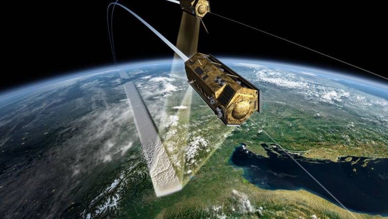
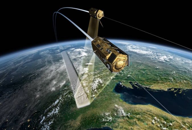
Complementary to ESA Earth observation missions, ESA’s Third Party mission (TPM) programme allows researchers free access to a large portfolio of commercial and non-ESA remote sensing data for scientific purposes. Germany’s TanDEM-X mission is one such third-party mission. It is based on two almost identical satellites, TerraSAR-X and TanDEM-X from DLR (the German Aerospace Centre), which are equipped with powerful synthetic aperture radar (SAR) systems. The mission started with TerraSAR-X in 2007 and was enhanced with the TanDEM-X add-on for digital elevation measurement (DEM).
Two Satellites Generate 3D Maps
Just as a human's slightly separated eyes produce two different 2D images, which are interpreted as depth – or 3D – in the brain, the two TanDEM-X satellites are capable of generating a 3D elevation model of the entire Earth surface.
Researcher Christian Sommer, from the project, explained: “We took the raw radar data from TanDEM-X, with a resolution of about 10 metres, and then performed radar interferometry to produce digital elevation models. By comparing such models over multiple years, we could then produce a time series to show how mountainous glaciers are evolving over time.”

Value staying current with geomatics?
Stay on the map with our expertly curated newsletters.
We provide educational insights, industry updates, and inspiring stories to help you learn, grow, and reach your full potential in your field. Don't miss out - subscribe today and ensure you're always informed, educated, and inspired.
Choose your newsletter(s)


