Mosaic Integrates 360º Camera with RIEGL Lidar Technology
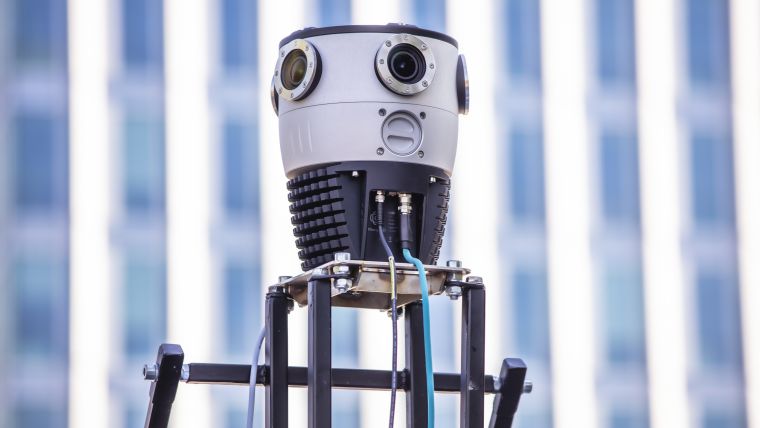
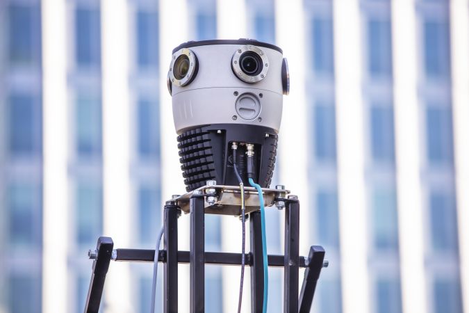
Mosaic has announced that the company’s new Mosaic X spherical camera is now compatible with RIEGL’s mobile mapping systems. RIEGL V-Line scanners are currently some of the highest performing and most widely recognized mobile laser scan systems in the world. Mosaic is a designer and producer of high-resolution 360º mobile mapping cameras.
The development of the Mosaic X focused on delivering a high-resolution, global-shutter, 360° camera with precise GNSS time stamping to achieve extreme visual clarity and accuracy at once. Due to this, the Mosaic X meets the requirements to be integrated with mobile laser scanning systems such as the RIEGL VMX, VMQ and VMY series.
Capturing Road Infrastructure with Photo-realistic Accuracy
Mobile mapping has far-reaching uses across a breadth of industries and sectors, from private to public organizations, and from insurance and engineering firms to telecom and utility surveying companies. Each end user has different demands on the mapping of their infrastructure, but the two most consistent demands are for high-resolution photo-realistic imagery and highly accurate, dense, feature-rich data.
Mobile mapping systems, such as the RIEGL VMY-1, the RIEGL VMY-2, the RIEGL VMQ-1HA, and the RIEGL VMX-2HA, are recording 3D data of object surfaces in a time-efficient and highly accurate manner.
Mobile mapping cameras such as the Mosaic 51 and Mosaic X capture road infrastructure with photo-realistic accuracy, which is much more understandable to the human eye than a point cloud from a laser scanner.
Unleashing the Potential of Precise Point Clouds
Rostislav Lisovy, co-founder of Mosaic and vice president of engineering, explained the advantages that customers can expect to enjoy: “The pairing between 360° imaging systems and mobile laser scanning systems results in high-precision Lidar-based point clouds, colourized by photo-realistic images. This outcome will then have the benefit of both a precise point cloud and panoramic images – for precise measurements and evaluation of textures.”
“Our customers will be able to gather more valuable data which will assist in the process of automatically assessing the state of infrastructure from the point cloud data – rather than just from a panorama image.”
Jeffrey Martin, Mosaic CEO and co-founder, stated: “We have had many requests from our customers who are looking to use RIEGL and Mosaic products in unison. The Mosaic X impresses with high-resolution panorama images and offers precisely time-stamped single lens imagery for the purpose of point cloud colouring as well as the generation of undistorted, georeferenced high-resolution imagery with 12MP per lens”.

Value staying current with geomatics?
Stay on the map with our expertly curated newsletters.
We provide educational insights, industry updates, and inspiring stories to help you learn, grow, and reach your full potential in your field. Don't miss out - subscribe today and ensure you're always informed, educated, and inspired.
Choose your newsletter(s)


