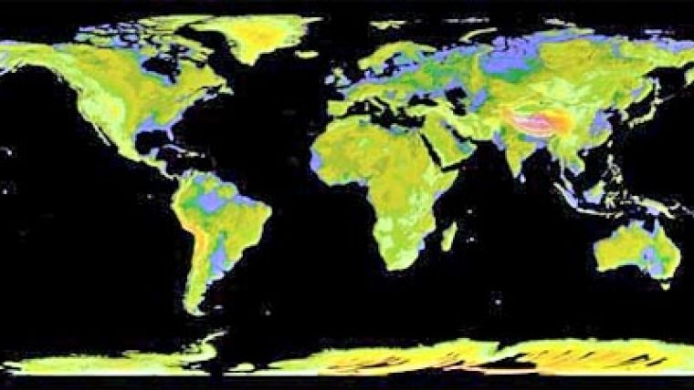
Most Complete Topographic Map of Earth
NASA and Japan released a new digital topographic map of Earth Monday that covers more of our planet than ever before. The map was produced with detailed measurements from NASA's Terra spacecraft. The new global digital elevation model of Earth was created from nearly 1.3 million individual stereo-pair images collected by the Japanese Advanced Spaceborne Thermal Emission and Reflection Radiometer, or ASTER, instrument aboard Terra. NASA and Japan's Ministry of Economy, Trade and Industry (METI), developed the data set. It is available online to users everywhere at no cost.
According to Mike Abrams, ASTER science team leader at NASA's Jet Propulsion Laboratory in Pasadena (CA, USA), the new topographic information will be of value throughout the Earth sciences and has many practical applications.
Previously, the most complete topographic set of data publicly available was from NASA's Shuttle Radar Topography Mission. That mission mapped 80 percent of Earth's landmass, between 60° north latitude and 57° south. The new ASTER data expands coverage to 99%, from 83° north latitude and 83° south. Each elevation measurement point in the new data is 98 feet apart.
The ASTER data fill in many of the voids in the shuttle mission's data, such as in very steep terrains and in some deserts," said Michael Kobrick, Shuttle Radar Topography Mission project scientist at the Jet Propulsion Laboratory.
NASA and METI are jointly contributing the ASTER topographic data to the Group on Earth Observations, an international partnership headquartered at the World Meteorological Organization in Geneva (Switzerland), for use in its Global Earth Observation System of Systems. This "system of systems" is a collaborative, international effort to share and integrate Earth observation data from many different instruments and systems to help monitor and forecast global environmental changes.
NASA, METI and the U.S. Geological Survey validated the data, with support from the U.S. National Geospatial-Intelligence Agency and other collaborators. The data will be distributed by NASA's Land Processes Distributed Active Archive Center at the U.S. Geological Survey's Earth Resources Observation and Science Data Center in Sioux Falls, S.D., and by METI's Earth Remote Sensing Data Analysis Center in Tokyo.
ASTER is one of five Earth-observing instruments launched on Terra in December 1999. ASTER acquires images from the visible to the thermal infrared wavelength region, with spatial resolutions ranging from about 50 to 300 feet. A joint science team from the U.S. and Japan validates and calibrates the instrument and data products. The U.S. science team is located at NASA's Jet Propulsion Laboratory.
Visualisations of the new ASTER topographic data
Data users can download the ASTER global digital elevation model

Value staying current with geomatics?
Stay on the map with our expertly curated newsletters.
We provide educational insights, industry updates, and inspiring stories to help you learn, grow, and reach your full potential in your field. Don't miss out - subscribe today and ensure you're always informed, educated, and inspired.
Choose your newsletter(s)


