New Mobile Indoor Mapping System Launched
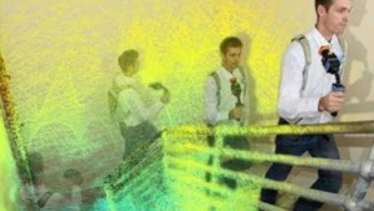
The Zebedee hand-held mapping device is designed to be used both indoors and outdoors for applications where GPS cannot be used, such as forestry. 3D Laser Mapping is licensing the technology – which was initially developed by Australia's national science agency, CSIRO – from the UK-based start-up GeoSLAM.
Zebedee evolved from CSIRO's need to map a set of caves, explained Elliot Duff, an expert in robotics at the Australian agency. Faced with the inconvenience of having to abseil into the cave system carrying bulky equipment including a motor, battery and computer on a trolley, he and his colleagues developed a system that uses human motion – or ‘passive actuation’ – rather than a machine to drive the motor of the sensor.
Zebedee uses the environment to calculate trajectory: the Lidar becomes a trajectory sensor, comparing the trajectories of sets of features. The accuracy of the whole system is dependent on both the accuracy of the laser scanner and the feature-richness of the environment (e.g. mapping a long, featureless corridor or room is problematic).
Scan data is currently processed offline via Dropbox, although the intention is to process the data online in real time in the future. This would allow maps to be created on the spot, continued Duff, which has applications for first responders, emergency services and security.

Value staying current with geomatics?
Stay on the map with our expertly curated newsletters.
We provide educational insights, industry updates, and inspiring stories to help you learn, grow, and reach your full potential in your field. Don't miss out - subscribe today and ensure you're always informed, educated, and inspired.
Choose your newsletter(s)


