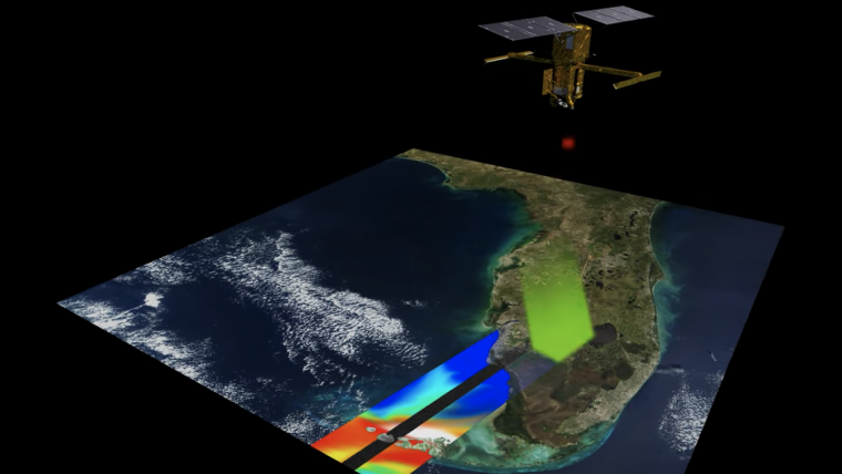
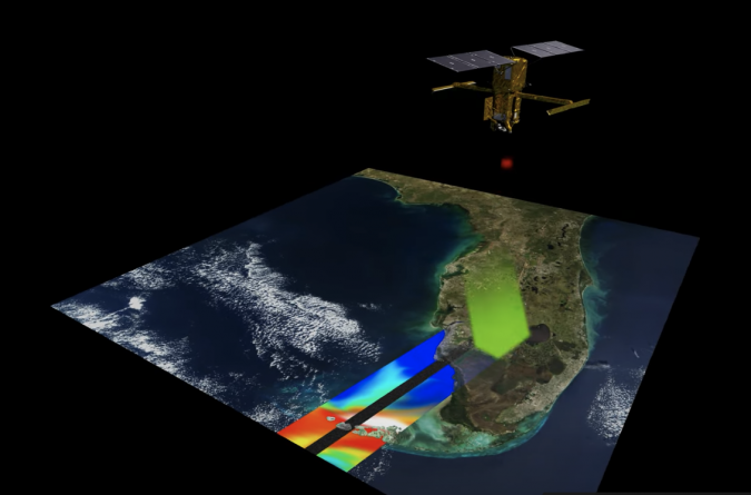
New Satellite Set to Revolutionize Understanding of Water on Earth
SpaceX, the space exploration company, launched a research satellite into orbit on Friday 16 December 2022. Named SWOT (Surface Water and Ocean Topography), the satellite – which is the size of a large car – will measure the water level on more than 90% of the planet’s surface from its position 890km above the Earth. Scientists will use this data to identify areas vulnerable to flooding or extreme drought, as well as to track the rate of rising sea levels and the resulting coastal erosion.
It will take SWOT three weeks to map the world’s water. By regularly repeating the process, scientists will be able to gain insight into water currents and create a complete picture of the world. Thanks to advanced technology, SWOT allows scientists to observe seas and oceans at previously unattainable scales.
Mapping Earth’s Water in Real Time
With this new high-resolution satellite, scientists can now capture the behaviour of Earth’s water bodies in real time. This allows for the detection of changes that necessitate accuracy to the centimetre level, such as the motion of coastal currents or streams or rivers. The goal of the satellite mission is to observe the water cycle in all oceans, rivers and seas for a minimum of 3.5 years.
The satellite was developed by the American and French space agencies NASA and CNES, with financial support from Canada and the United Kingdom.

Value staying current with geomatics?
Stay on the map with our expertly curated newsletters.
We provide educational insights, industry updates, and inspiring stories to help you learn, grow, and reach your full potential in your field. Don't miss out - subscribe today and ensure you're always informed, educated, and inspired.
Choose your newsletter(s)


