New Version of Point Cloud Plug-in Unveiled for AutoCAD
InfoEra, Lithuania, has announced the release of its Undet ToolBox V2. Undet is a plug-in for AutoCAD and its verticals that facilitates evaluation, visualisation, processing and advanced modelling of point clouds. It has been developed to provide best value for users who want to work efficiently with point clouds in AutoCAD and to speed up as-built documentation for multiple laser scanning tasks.
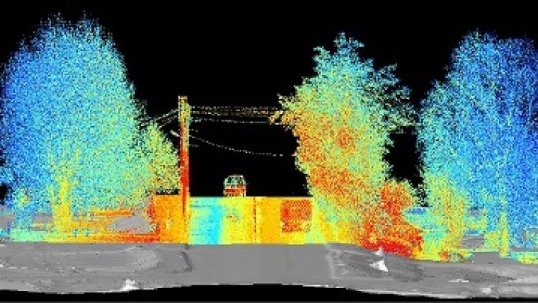
Next to the first-version developments of a comprehensive management of point clouds data, visibility and colouring, V2 has a number of new impressive features focused on critical information extraction from point clouds. With this release, Undet delivers a complete set of tools for terrestrial and mobile mapping deliverables in an AutoCAD environment.
Meshing and texture mapping
Undet Toolbox makes it possible to mesh extracts of irregular 3D surfaces, eliminating the time-consuming point cloud filtering step. It automatically excludes trashes, reflections and other objects such as vegetation, houses, cars and street furniture. Mesh editing tools make it possible to join different meshes, close holes and remove long edges or spikes. Additionally the toolbox includes implemented mesh sectioning for fast surface profiling and texture mapping for better surface interpretation and visualisation.
A new dialogue developed for fast and easy point cloud sectioning in synergy with automated recognition is a powerful tool for extraction of plans, sections, irregular profiles and 3D modelling.
Along with automated UCS alignment and tracking, Undet ToolBox now recognises and extracts 2D and 3D primitives: plane, line, corer line, circles, box, cylinder and sphere. Additionally developed 3D solid fitting to the point cloud object’s volume allows automated modelling (sculpting) of complex structures.
Ortho-images
Newly developed analysis allows deformation tolerance to be set up and deformation maps to be investigated. Users can pick up deformation values directly on the image and print it or simply save and share. Additionally, improved ortho-generation from point clouds now allows creation of true and projected ortho-images.
It is a new navigation method which enables users to see point clouds just as if they were standing right where the laser scanner captured the scan data. This allows them to navigate naturally and intuitively, evaluate point clouds, proceed virtual surveying, measure distances or extract correct geometries using automated recognition. Navigating in Undet True View mode, users will no longer experience confusing point clouds. Such a navigation method is also great for inexperienced users or tasks like interior fittings and wireframe modelling because they are able to quickly extract planes, corner lines and other 3D objects.

Value staying current with geomatics?
Stay on the map with our expertly curated newsletters.
We provide educational insights, industry updates, and inspiring stories to help you learn, grow, and reach your full potential in your field. Don't miss out - subscribe today and ensure you're always informed, educated, and inspired.
Choose your newsletter(s)


