Oblique Aerial Images to Upgrade Mexican Maps
GeoAir, an aerial mapping company, took vertical and oblique aerial images to upgrade maps for 15 municipalities in the State of Mexico, one of the 31 states of Mexico. GeoAir used the Microsoft UltraCam Osprey to take both required types of images at once, which allowed the company to halve costs and improve efficiency while obtaining accurate, high-quality images for the Instituto de Información e Investigación Geográfica, Estadística y Catastral del Estado de México (IGECEM).
In 2014, GeoAir – a Mexican company that specialises in aerial photography – was hired by the GeoMapa company, which specialises in photogrammetry, mapping, and cadastral. GeoMapa won a bid to conduct a cartographic update of 15 municipalities in the State of Mexico through the Instituto de Información e Investigación Geográfica, Estadística y Catastral del Estado de México (IGECEM) and asked GeoAir to manage the aerial survey flights, a crucial element of the project.
The IGECEM is a public body affiliated with the Secretariat of Finance of Mexico State. Its purpose is to operate and maintain the geographical information and research system for the State of Mexico. To provide the best possible service, the IGECEM must stay up-to-date with high-quality and accurate maps.
The organisation was established in 2000 to develop a cartographic record of the 125 municipalities that make up the State of Mexico, which it did using digital images from various sources. However, the information was not standardised, and the data from different companies lacked official confirmation. For this reason, it was very costly to make use of the material.
Modernisation process
As part of its modernisation process, the IGECEM wanted to consolidate and update maps of the 15 most densely urbanised towns in the state: 13 in the Valle de México area and two in Valle de Toluca. Francisco Sánchez, director of geography at the IGECEM said the organisation’s goal was to complete the project with one partner in order to use the same criteria for all of the acquired images and data. Complying with all IGECEM regulations was also a must.
In addition, the IGECEM wanted to gather oblique images (captured at an angle of approximately 45 degrees), which provide information unavailable in vertical images. They can see building facades and elements covered by roofs, said Sánchez. GeoMapa was tasked with providing images with a ground sampling distance (GSD) of 10 centimetres, a forward lap of 60 percent, a side lap of 30 percent, and less than a 5-degree margin of error. The images also had to show good contrast and low haze. Due to these specific needs, GeoMapa hired GeoAir.
Solution
With these goals in mind, GeoAir came up against an obstacle: the company did not have oblique cameras, only vertical ones. They had the option of flying twice [to use both cameras], but this costs almost twice as much, said Wolfgang Kost, general director of GeoAir. The goal was to do the job in the shortest possible amount of time, taking into account that air traffic in Mexico City is dense and the weather is unpredictable.
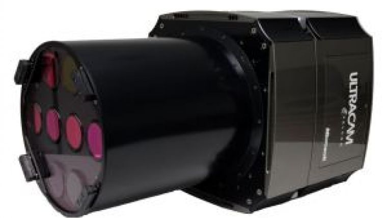
GeoAir employed the UltraCam Osprey and found the ideal solution for delivering what the IGECEM wanted: the camera makes it possible to capture oblique and vertical images simultaneously. According to Kost, this reduces direct and operational costs by half because only one flight is needed. With UltraCam Osprey, it is possible to fly higher and get much higher resolution than with other commercial cameras, he said..
GeoAir worked with GeoMapa on the IGECEM project in early 2014. Over 15 total flight days, a twin-engine Cessna 402 flew for about 63 hours at an altitude of 2,800 feet. The project had a total surface area of 2,010 square kilometres and almost 4,300 linear kilometres, with a GSD of 10 centimetres.
In the end, the IGECEM received more than 122,000 images, 18,000 of them vertical. All images were processed in-house by GeoAir with Microsoft UltraMap photogrammetric workflow software and integrated in a visualisation application provided by GeoMapa.
According to Sánchez, the IGECEM has already proposed the second phase of the project, which will include 42 more municipalities. The State of Mexico has been a local pioneer for this technology, and Sánchez hopes to continue to work with it. This information will be very useful not only for the IGECEM, but also for other sectors that can take advantage of these cartographic resources.
Benefits
The UltraCam Osprey enabled GeoMapa and GeoAir to comply with the IGECEM’s requirement of oblique and vertical images. Though it is possible to achieve similar results using different cameras, with the UltraCam Osprey it is not necessary to overlap separate images, Kost explained. This reduces image processing times so that the customer receives the product sooner.
Mexico City has fairly heavy air traffic, especially during peak hours. This makes it more difficult to get permission to fly, and the city is surrounded by mountains that may cause weather complications. By using UltraCam Osprey to take oblique and vertical images at once, GeoAir could fly fewer times and get the job done faster.
GeoAir aims to offer modern services to private companies like GeoMapa and regional institutions in Mexico and Central America. According to Kost, the innovative mapping technology used for the initial IGECEM project will soon be required more broadly, given the positive results. By using the UltraCam Osprey, the company is redefining standard paradigms, according to Sánchez. He said they have evolved from the use of conventional images.
With its large footprint, the UltraCam Osprey can deliver high-quality images with greater efficiency. This made a big difference for the IGECEM, which wanted images with good contrast, low haze, and great precision. As Sánchez noted: the oblique images provided them with a perfect perspective of building facades and all related information. This made the images more useful to the IGECEM.

Value staying current with geomatics?
Stay on the map with our expertly curated newsletters.
We provide educational insights, industry updates, and inspiring stories to help you learn, grow, and reach your full potential in your field. Don't miss out - subscribe today and ensure you're always informed, educated, and inspired.
Choose your newsletter(s)


