Online Lidar Map of Britain
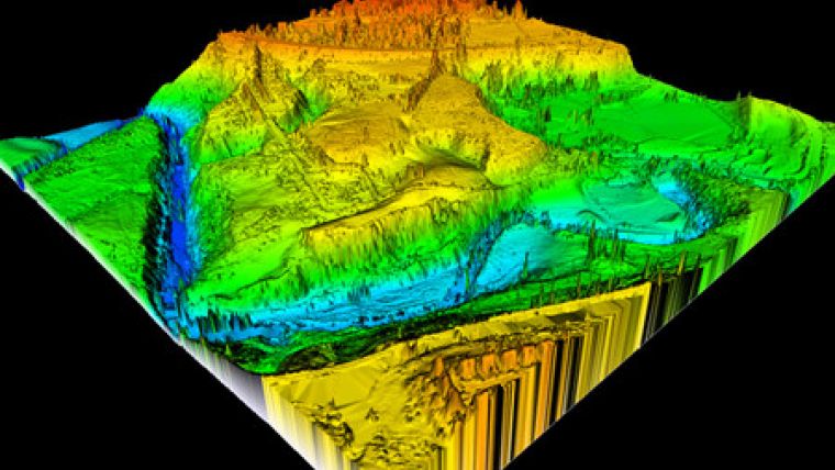
Aerial survey company Bluesky, UK, has launched a comprehensive online Lidar map of the UK. It covers approximately 75% of England and Wales, including all major towns and floodplains, plus areas of Scotland. The Lidar coverage ranges in vertical accuracy from 5cm to 15cm, and in spatial resolution from 25cm to 2m. The online map can be searched using a place name, postcode or geographical coordinates before purchasing data of the chosen area and downloading digital files.
By combining data from many sources, including Bluesky's archive, the company has created accessible and comprehensive online coverage of Lidar data, commented Rachel Tidmarsh, managing director of Bluesky.
Available online, in a range of formats suitable for use in Geographical Information System (GIS), Computer Aided Design (CAD) or 3D visualisation software, the Lidar data is designed for applications that require an accurate real-world representation of the Earth's surface and the vegetation and buildings that cover it. From simple identification of ground surface features to more complex projects including flood risk assessment and mobile network planning, the data is offered free of Crown Copyright with flexible licensing terms.

Value staying current with geomatics?
Stay on the map with our expertly curated newsletters.
We provide educational insights, industry updates, and inspiring stories to help you learn, grow, and reach your full potential in your field. Don't miss out - subscribe today and ensure you're always informed, educated, and inspired.
Choose your newsletter(s)


