Orbit GT and RIEGL Strengthen Data Interoperability for Terrestrial Scanning
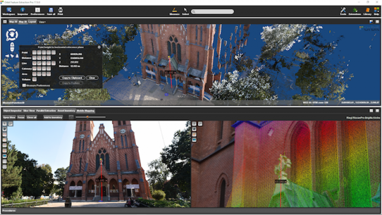
Orbit GT and RIEGL are strengthening data interoperability for terrestrial scanning by making data exchange between software systems much easier than before. Orbit GT and RIEGL share a common view that data interoperability should be as easy as possible, also for quite complex and large datasets, as are abundant in the scanning business, said Peter Bonne, CEO of Orbit GT. RIEGL has done a great effort to bring this interoperability to the next level and make results from terrestrial scanning ready for Orbit GT’s portfolio of Lidar and Imagery data management, feature extraction and publishing software, he added.
Providing georeferenced panorama image exports with the latest release of RiSCAN PRO is another step towards the common goal of eroding the barrier between kinematic and static laser scanning and process the data in a shared environment such as Orbit’s MM Feature Extraction Bundle Software, said Christian Sevcik, manager strategic software alliances. With this update, it has never been easier to combine Lidar data and imagery collected with a static laser scanner like the RIEGL VZ-400i with mobile mapping data, he concluded.

Value staying current with geomatics?
Stay on the map with our expertly curated newsletters.
We provide educational insights, industry updates, and inspiring stories to help you learn, grow, and reach your full potential in your field. Don't miss out - subscribe today and ensure you're always informed, educated, and inspired.
Choose your newsletter(s)


