Palm Oil Industry Invests in Radar Monitoring to Detect Deforestation
A coalition of ten major palm oil producers and buyers are collaborating to support and fund the development of a new, publicly available radar-based forest monitoring system known as Radar Alerts for Detecting Deforestation (RADD). This partnership, formed by multinationals such as Nestlé, Pepsico, Unilever and Wilmar, is set to make it much easier for companies to see deforestation happening in near real time and with greater accuracy. With this information, they can more quickly mobilize follow-up actions on the ground and work to improve the sustainability of commodity supply chains.
The RADD system is currently being developed for Indonesia and Malaysia. Preliminary results for Indonesia and Malaysia indicate that the new RADD system can detect tropical deforestation several weeks earlier than optical-based systems.
Penetrate cloud cover
Developed by Wageningen University and Satelligence, both based in The Netherlands, and facilitated by World Resources Institute, the RADD system will augment existing publicly available monitoring tools that rely on optical-based satellite imagery, which can be delayed when clouds obstruct the view of forests. Through the use of radar waves, the new system can penetrate cloud cover and gather forest change information without being affected by clouds or sunlight.
What makes RADD unique is that it is the first radar-based monitoring system of this scale that will make deforestation alerts publicly available. Once the system is complete, the alerts will be available on Global Forest Watch and Global Forest Watch Pro, and the methodology behind the alerts will be published.
Sentinel satellites
The new system will utilize freely available radar data from the European Space Agency’s Sentinel-1A and B satellites, which orbit the Earth every six to 12 days. These satellites provide high spatial detail that will also improve detection of smaller clearing events.
Throughout the RADD system development over the next two years, partner companies will receive alerts about detected deforestation events and will provide crucial feedback to improve the system. The open nature of the system will enable companies - plus governments, civil society organizations and concerned stakeholders - to monitor forests using the same information source and standards.
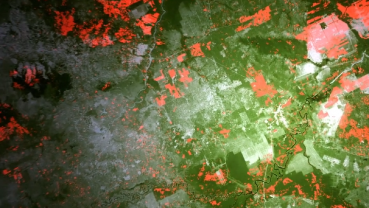
Source: Satelligence.

Value staying current with geomatics?
Stay on the map with our expertly curated newsletters.
We provide educational insights, industry updates, and inspiring stories to help you learn, grow, and reach your full potential in your field. Don't miss out - subscribe today and ensure you're always informed, educated, and inspired.
Choose your newsletter(s)


