Photogrammetric Software Suite for UAS
PIEneering, Finland, has released a complete photogrammetric software system, RapidStation suite, for processing digital imagery acquired with Unmanned Aerial Systems (UAS), aircrafts and helicopters. The software suite covers the entire photogrammetric workflow and has been specifically tuned for challenging UAS projects.
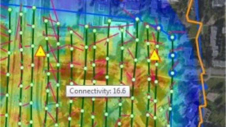
RapidStation includes automated aerial triangulation (AAT) along with fully automated generation of very dense point clouds (DSM/DTM) and production of true-orthos and orthomosaics.
The software system combines ease of use with rigid photogrametry and machine vision technologies. It is suitable for both professional photogrammetrists and GIS producers seeking a good solution for processing their digital imagery. The highlights of RapidStation are high degree of automation, modern GIS-like user interface with powerful data management tools, extensive quality assurance and reporting capabilities and comprehensive modelling options for aerial triangulation. Additionaly, RapidStation includes Semi Global Matching module for 3D modelling that offers a production boost by utilising the processing power of multiple GPU’s. Batch processing support is also available throughout the software suite.

Value staying current with geomatics?
Stay on the map with our expertly curated newsletters.
We provide educational insights, industry updates, and inspiring stories to help you learn, grow, and reach your full potential in your field. Don't miss out - subscribe today and ensure you're always informed, educated, and inspired.
Choose your newsletter(s)


