PlanetObserver Presents Global Elevation Model
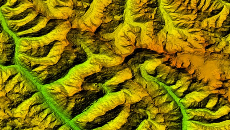
PlanetObserver, a specialist of geospatial data production, has announced the release of PlanetDEM 30 Plus global elevation model. PlanetDEM 30 Plus is the new Digital Elevation Model from the PlanetDEM range that offers global coverage at 30 metre resolution with seamless, accurate and reliable data.
PlanetDEM 30 Plus is a multi-source elevation model based on SRTM 30m dataset extensively corrected and enhanced with ASTER data, and other elevation data for high latitudes regions. Advanced processing techniques developed by PlanetObserver have been applied to compile and extensively reprocess those multi-source data. The result is an elevation product with 30 metre resolution for the entire Earth’s landmass.
Available off-the-shelf in different standard formats, PlanetDEM 30 Plus elevation model is adapted to many projects: 3D visualisation and simulation for commercial or military applications, imagery orthorectification, mapping solutions, energy, telecommunication, and more.
To find out more about PlanetDEM 30 Plus elevation data, visit the PlanetObserver website at www.planetobserver.com.

Value staying current with geomatics?
Stay on the map with our expertly curated newsletters.
We provide educational insights, industry updates, and inspiring stories to help you learn, grow, and reach your full potential in your field. Don't miss out - subscribe today and ensure you're always informed, educated, and inspired.
Choose your newsletter(s)


