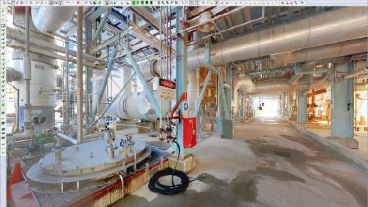
Point Cloud Solution for Processing Laser Scan Data
With Leica Cyclone 9.0, a point cloud solution for processing laser scan data, Leica Geosystems HDS has introduced patent-pending innovations for greater project efficiency. According to the company, these advances aim to benefit both field and office via significantly faster and easier scan registration plus quicker deliverable creation thanks to better 2D and 3D drafting tools and steel modelling. Cyclone 9.0 is developed to allow users to scale easily for larger, more complex projects while consistently ensuring high-quality deliverables.
When Leica Geosystems pioneered cloud-to-cloud registration, it enabled users to accurately execute laser scanning projects without having to physically place special targets around the scene, scan them, and model them in the office. With cloud-to-cloud registration software, users take advantage of overlaps among scans to register them together.
The cloud-to-cloud registration approach has delivered significant logistical benefits onsite and time savings for many projects. It has been constantly improved, but the new Automatic Scan Alignment and Visual Registration capabilities in Cyclone 9.0 represent the biggest advancement in cloud-to-cloud registration since it was introduced, explained Dr Chris Thewalt, vice-president laser scanning software. Cyclone 9.0 lets users benefit from targetless scanning more often by performing the critical scan registration step far more efficiently in the office for many projects. As users increase the size and scope of their scanning projects, Cyclone 9.0 pays even bigger dividends. Any user who registers laser scan data will find great value in these capabilities, Thewalt added.
Combined capabilities
With the push of a button, Cyclone 9.0 automatically processes scans and, if available, digital images to create groups of overlapping scans that are initially aligned to each other. Once scan alignment is completed, algorithmic registration is applied for final registration. This new workflow option can be used in conjunction with target registration methods as well. These combined capabilities not only make the most challenging registration scenarios feasible, but also exponentially faster. Even novice users will appreciate their ease-of-use and ready scalability beyond small projects.
Power user Marta Wren, technical specialist at Plowman Craven Associates (PCA - leading UK chartered surveying firm) found that Cyclone 9.0’s Visual Registration tools alone sped up registration processing of scans by up to four times faster than previous methods. PCA uses laser scanning for civil infrastructure, commercial property, forensics, entertainment and Building Information Modelling (BIM) applications.
2D and 3D drafting
For civil applications, new roadway alignment drafting tools let users import LandXML-based roadway alignments or use simple polylines imported or created in Cyclone. These tools allow users to easily create cross section templates using feature codes, as well as copy them to the next station and visually adjust them to fit roadway conditions at the new location. A new vertical exaggeration tool in Cyclone 9.0 allows users to clearly see subtle changes in elevation; linework created between cross sections along the roadway can be used as breaklines for surface meshing or for 2D maps and drawings in other applications.
For 2D drafting of forensic scenes, building and BIM workflows, a new Quick Slice tool streamlines the process of creating a 2D sketch plane for drafting items, such as building footprints and sections, into just one step. A user only needs to pick one or two points on the face of a building to get started. This tool can also be used to quickly analyse the quality of registrations by visually checking where point clouds overlap.
Also included in Cyclone 9.0 are powerful, automatic point extraction features, first introduced in Cyclone II TOPO and Leica CloudWorx. These include efficient SmartPicks for automatically finding bottom, top, and tie point locations and Points-on-a-Grid for automatically placing up to a thousand scan survey points on a grid for ground surfaces or building faces.
Steel fitting
For plant, civil, building and BIM applications, Cyclone 9.0 also introduces a patent-pending innovation for modelling steel from point cloud data more quickly and easily. Unlike time consuming methods that require either processing an entire available cloud to fit a steel shape or isolating a cloud section before fitting, this new tool lets users to quickly and accurately model specific steel elements directly within congested point clouds. Users only need to make two picks along a steel member to model it. Shapes include wide flange, channel, angle, tee, and rectangular tube shapes.
Leica Cyclone 9.0 also provides users with valuable, new capabilities for faster creation of deliverables for civil, architectural, BIM, plant, and forensic scene documentation from laser scans and High-Definition Surveying (HDS).
Further information about the Leica Cyclone family of products can be found at http://hds.leica-geosystems.com.

Value staying current with geomatics?
Stay on the map with our expertly curated newsletters.
We provide educational insights, industry updates, and inspiring stories to help you learn, grow, and reach your full potential in your field. Don't miss out - subscribe today and ensure you're always informed, educated, and inspired.
Choose your newsletter(s)


