Precision Agriculture: Customised Nitrogen Fertilisation to Maximise Economic and Environmental Gains
Canadian agriculture has an international reputation for being highly productive and modern. The sector plays a major role in the country’s economy and contributes to 8% of GDP (approximately USD82 billion dollars) and 12% of jobs (2.1 million people). For the past few years, in order to optimise performance and revenue while respecting the environment, producers have been counting on a new ally: precision agriculture. This article explains how satellite images are used to obtain much of the information required.
(By Yacine Bouroubi, Effigis, Canada)
Everyone involved in Canada’s agricultural sector (decision-makers, producers and advisors) is aware of the environmental issues associated with farming (air and water pollution, land and biodiversity degradation), and is committed to developing sound and sustainable agriculture, the smart use of agricultural inputs (fertilisers, pesticides and herbicides) and conserving natural resources. For the past few years, in order to optimise performance and revenue while respecting the environment, producers have been counting on a new ally: precision agriculture. Using technologies such as GPS, auto-guidance, variable rate technology, yield sensors, satellite images, drones, etc., precision agriculture is now part of the day-to-day life of farmers. The application of agricultural inputs based on the four Rs (i.e., the right source at the right rate, in the right place at the right time) must be based on scientific knowledge and technical know-how. Such knowledge and know-how are based on reliable, accurate and complete information, which is often necessary on a global scale, but with a rather fine spatial resolution. Satellite images are the ideal tool to provide much of the information required.
Source of information
For about 15 years now, sensors on very high spatial resolution (VHR) Earth observation (EO) satellites have been offering a source of data that can provide information on soils and crops at adequate spatial scales (around 2m using multispectral imagery) with an unbeatable price/quality ratio. A VHR multispectral image can cover hundreds of fields with a metric resolution at a cost of under USD1.34/ha. More recently, agile satellite constellations, such as Pléiades, have achieved the long-awaited performance in terms of temporal resolution for agricultural applications, namely, a daily revisit, acquisition programming over very short periods and high-speed image delivery. This advantage is critical given that crop health diagnosis is required at very specific growth stages. There has been a lot of research on translating satellite data into useful agricultural information, and this research has shown the operational usefulness of this data in the agricultural service sector. Thus, “products derived for agriculture” that are reliable and ready to use can be generated at adequate temporal and spatial scales for applications related to the determination of soil properties, growth monitoring, early disease detection, estimation of input needs (in particular in “variable rate” mode), yield forecasting, damage evaluation, etc.
In spite of this real potential, the link in the chain that brings together the phenomenal quantity of data produced by the EO sensors and their operational use to meet the needs of agricultural sector users has to date remained rather weak. Products derived from satellite images for estimating the quantity of nitrogen fertilisation to meet plants’ nutritional requirements are a concrete example of such an operational use.
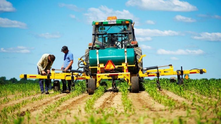
Nitrogen Fertilisation
Nitrogen is to agriculture what hay is to cattle. Nitrogen is a key element in the molecular structure of chlorophyll, the most important constituent in plants. Chlorophyll allows the plant to absorb sunlight and convert it into energy. With adequate nitrogen supply, the plant transforms more solar energy into biomass and crop yields.
Nitrogen fertilisation is an indispensable means of increasing crop yields. However, determining the optimal dose of nitrogen is not easy, since it depends on complex interactions between plants, the soil, weather conditions and management practices. By wanting to avoid performance loss due to nitrogen deficiencies, current practices favour overfertilisation, which leads to unnecessary costs as well as serious environmental problems: soil degradation, nitrate leaching (source of eutrophication) in the water, and ammonia volatilisation (ammonia is a powerful greenhouse gas) in the air.
Mathematical and mechanistic approaches to nitrogen cycle and crop growth modelling are very useful for the theoretical understanding of processes, but inadequate for determining the optimal doses for fertilisation in practice. In addition to requiring numerous inputs that are impossible to determine with accuracy, these approaches are prone to the propagation of errors inherent to the models of each process. Agriculture and Agri-Food Canada (AAC) developed a model based on the use of statistical analyses for the understanding of the direct relationship between the properties that influence nitrogen requirements (soil, growth, weather and management) and the response to nitrogen fertilisation, based on a large number of fertilisation trials. These relationships were implemented as a decision-support system (DSS), which is called SCAN (Soil, Crops and Atmosphere for Nitrogen management, ref. Tremblay et al., 2012)), and is based on artificial intelligence techniques that are best adapted to manage imprecise and complex relationships. The satellite imagery acquired at a specific growth stage provides one of the information types required for the operation of SCAN, i.e., crop status.
Agronomic knowledge
SCAN stands out with two major innovations. The first involves extracting agronomic knowledge related to nitrogen fertilisation: studies on this issue have been conducted by applying the meta-analysis technique to databases containing hundreds of fertiliser trials collected from many researchers in Canada and the United States (see ref. Tremblay et al., 2012). The second innovation involves modelling this agronomic knowledge in the form of inference rules in a fuzzy logic system (see ref. Bouroubi et al., 2011). Work is ongoing to advance these two aspects of SCAN and validate it for various agricultural regions, as well as adapt it to various types of crops. Studies carried out as part of SCAN’s development have been cited many times during international precision agriculture conferences, as a major innovation in this field.
A SCAN Web platform will be tested by some 100 users starting in the summer of 2016, in anticipation of its commercial use in 2017.
In practical application conditions, “intelligent” nitrogen fertilisation provides excellent returns on investment, translating into maximum net revenue (optimised crop yields and reduced fertilisation costs), not to mention indirect savings related to environmental gains.
Potential
The use of precision agriculture continues to increase in Quebec and elsewhere in the world (Bouroubi and Bélanger, 2015). With its privileged access to all adequate satellites (in terms of spatial, spectral and temporal resolutions) and its expertise in the production of spatial information, Effigis has developed a range of products that will allow deriving the full potential of these images and respond to the needs of the agricultural sector in terms of soil mapping, stress detection, input recommendations in “management zones” or “variable rates” modes, performance forecasts, etc. These services shall soon be available as a Web mapping platform, with services linked to SCAN (nitrogen fertilisation) as well as other complementary services. SCAN will contribute to the democratisation of precision agriculture and provide it with significant benefits, thereby ensuring economic gains and sustainable development.
References
- Bouroubi Y., N. Tremblay, P. Vigneault, C. Bélec, B. Panneton and S. Guillaume, 2011, Fuzzy Logic Approach for Spatially Variable Nitrogen Fertilization of Corn Based on Soil, Crop and Precipitation Information. Lecture Notes in Computer Science, 2011, Volume 6782, 356-368.
- Tremblay, N., Y. Bouroubi, C. Bélec, R. Mullen, N. Kitchen, W. Thomason, S. Ebelhar, D. Mengel, B. Raun, D. Francis, E.D. Vories, and I. Ortiz-Monasterio. 2012. Corn Response to Nitrogen is Influenced by Soil Texture and Weather. Agronomy Journal, 104(6): 1658-1671. (www.dl.sciencesocieties.org/publications)
- Bouroubi Y. et M.-C. Bélanger, 2015. Réflexion sur l’état d’adoption des technologies d’agriculture de précision au Québec. Rapport du la commission de géomatique agricole et d’agriculture de précision du CRAAQ, juin 2015 (www.craaq.qc.ca/documents)

Value staying current with geomatics?
Stay on the map with our expertly curated newsletters.
We provide educational insights, industry updates, and inspiring stories to help you learn, grow, and reach your full potential in your field. Don't miss out - subscribe today and ensure you're always informed, educated, and inspired.
Choose your newsletter(s)


