Processing 40cm Products at European Space Imaging's DAF
European Space Imaging can now process 40cm imagery from WorldView satellites at its local Direct Access Facility (DAF) based near Munich, Germany. Imagery at 40cm is available from archive data or for new tasking orders from the WorldView constellation.
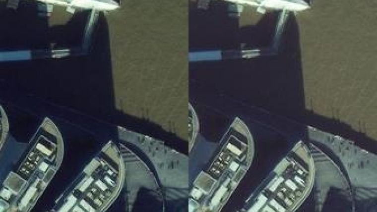
The above image of London illustrates the benefits of the higher-resolution imagery.
As the pixels are smaller, an image at 40cm is clearly smoother and provides more visible information. The image exposes more detail which makes it easier to differentiate between objects. Also colour variation is better defined, said product order manger, Tine Flingelli, after running tests on this near to nadir image.
According to DigitalGlobe what users can expect from smaller pixel resolution is an ability to resolve smaller features, see greater textures, extract features more accurately, have better photo interpretation, and enjoy a simply clearer picture.
Other benefits of 40cm include easier to see non-linear features, like circles and ground markings; improved image analysis for asset tracking and financial analysis or urban planning; and a finer detail to allow for greater feature extraction.
For more information or 40cm data inquiries you can contact European Space Imaging’s Customer Support Team.

Value staying current with geomatics?
Stay on the map with our expertly curated newsletters.
We provide educational insights, industry updates, and inspiring stories to help you learn, grow, and reach your full potential in your field. Don't miss out - subscribe today and ensure you're always informed, educated, and inspired.
Choose your newsletter(s)


