Propeller Aero and Wingtra to Deliver Drone Surveys for AEC Industry
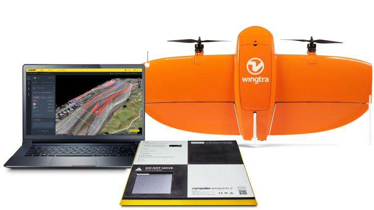
Propeller Aero and Wingtra have joined forces to deliver accurate site data and 3D mapping to construction and earthworks companies across the globe. Propeller Aero is a drone data visualization and analytics platform, while Wingtra manufactures vertical take-off and landing (VTOL) drones for mapping and surveying.
Designed specifically for the construction and earthworks industry, the Propeller Platform and WingtraOne drone partnership is aimed at enabling construction professionals to collect survey-grade data across their entire worksite, consistently and accurately. What used to take days or weeks can now be completed in hours, with more accuracy and reliability, according to the partners.
Smart ground control points
To operate, surveyors can place Propeller AeroPoints (smart ground control points) on their worksite, then fly the WingtraOne drone to collect worksite survey data. Survey images are uploaded to Propeller’s cloud-based platform where the fully automated geotagging and photogrammetry processing is completed within 24 hours of submission on the platform.
“Many Propeller customers are flying massive mines, road &railway projects and other large sites, and are seeing the value of VTOL drones for their operations,” said Jack Nachazel, customer success engineer at Propeller Aero. “Our partnership with Wingtra meets a significant demand in the industry for more efficient and highly accurate survey data that supports not only time and cost savings, but also reliable data."
Pre-construction bid precision
WingtraOne data collection with AeroPoints and Propeller PPK reduces risk and improves efficiency by serving as a reliable, single source for survey data and progress. Unlike traditional survey methods, which require manual, error-prone data collection, surveyors can quickly and easily fly their site on a regular basis to collect and process survey data.
Teams across the entire worksite can view geographically accurate and realistic 3D site models and track, inspect, and report on job progress and productivity safely and accurately. This increased accuracy and reliability has been shown to reduce conflict, more quickly resolve disputes and drive more pre-construction bid precision.
“Improving accuracy, reliability, and efficiency for survey data is imperative for our customers. Partnering with Propeller to provide a complete solution with the WingtraOne drone, AeroPoints, and Propeller’s PPK data processing and visualization is the right step toward better serving our customers,” said Julian Surber, product manager at Wingtra.

Value staying current with geomatics?
Stay on the map with our expertly curated newsletters.
We provide educational insights, industry updates, and inspiring stories to help you learn, grow, and reach your full potential in your field. Don't miss out - subscribe today and ensure you're always informed, educated, and inspired.
Choose your newsletter(s)


