Rapid UAV Mapping of Zurich Leads to Detailed Digital Twin
Switzerland-based professional drone company Wingtra has produced a high-precision digital twin of the city of Zurich that can be easily accessed by anyone through a link. Such rapid data collection and processing marks a shift in many industries like mapping for construction, infrastructure, architecture and design.
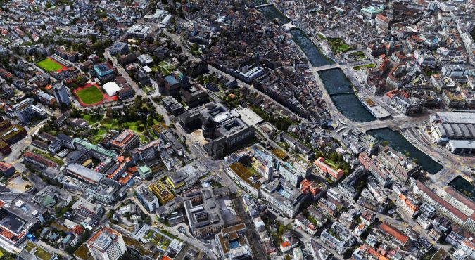
Detailed 3D data is essential to any city on the path to digital transformation. It allows city officials, urban planners, engineers and architects to design urban environments with better quality of life, and to plan and monitor critical infrastructure as well as simulate the effect of environmental changes.
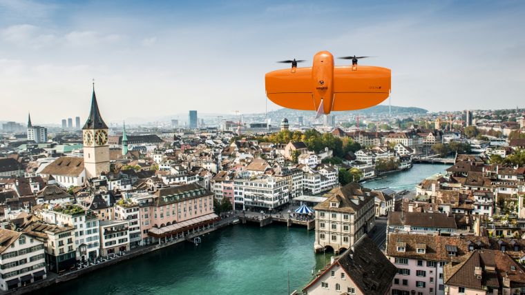
This data has been captured with a WingtraOne GEN II surveying drone, equipped with the Oblique Sony a6100 camera. It took only 6 flight hours to capture the geotagged imagery to create this digital twin covering 800 ha with a ground sampling distance (GSD) of 3cm per pixel. That means that 1 pixel in this 3D model represents 3cm of information from the real world, which is a remarkable level of detail.
Oblique imagery
Known in the mapping industry for its vertical take-off and landing (VTOL), centimetre level precision and dependable data capture over large areas, WingtraOne has been chosen by professionals from many industries worldwide. According to the Swiss company, the GEN II represents a solid step forward in industrialization and reliability along with some new perks that challenge the previous limits of commercial mapping drones.
“We wanted to make the WingtraOne drone even more versatile for our customers. So next to our flagship 42MP Sony RX1, we’re including new, high-end mapping payloads,” said Maximilian Boosfeld, co-founder and CEO of Wingtra. “I'm especially excited to announce our oblique solution, which offers outstanding 3D mapping results. It’s the perfect choice for capturing infrastructure – from a single industrial plant to full-scale cities.”
After six years in development and 100,000 user flights, Wingtra, the professional drone producer, recently launched WingtraOne GEN II, a next-generation VTOL drone that offers industrial reliability and mapping versatility with a new oblique camera configuration for high-quality 3D drone mapping data capture.
The digital twin of Zurich can be accessed here.

Value staying current with geomatics?
Stay on the map with our expertly curated newsletters.
We provide educational insights, industry updates, and inspiring stories to help you learn, grow, and reach your full potential in your field. Don't miss out - subscribe today and ensure you're always informed, educated, and inspired.
Choose your newsletter(s)


