RIEGL Introductions at Intergeo 2011
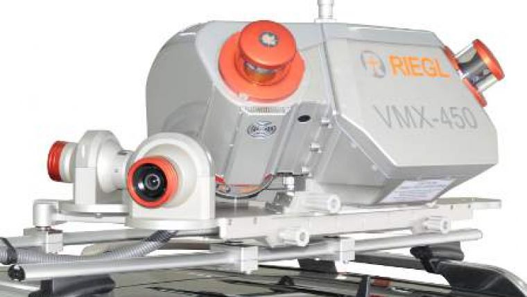
RIEGL Laser Measurement Systems is presenting a line of new products at Intergeo 2011: the VZ-4000 Terrestrial Laser Scanner providing very long range up to 4,000m; VMX-250 Mobile Laser Scanning System in an aerodynamic design, and its revolutionary sister type VMX-450 (image) with a laser pulse repetition rate of up to 1.1 MHz; VQ-580 Airborne Laser Scanner, especially designed for measuring on ice and snow, and the VQ-820-G Bathymetric Airborne Laser Scanner dedicated for coastline and shallow-water mapping.
RIEGL VZ-4000 is a new, compact, high-speed, high-resolution 3D VZ-Line Laser Scanner offering a wide field of view and an extremely long range of up to 4,000m. This development is suitable for operation in mining and topography. The scanner is characterised by high accuracy (15mm), a laser pulse repetition rate of up to 200kHz, echo digitisation and online waveform processing for multiple target capability and an optional waveform data output. User friendliness is ensured by a robust and compact design, built-in camera, on-board inclination sensors, integrated L1 GPS receiver with antenna, and built-in SSD data storage media.
RIEGL VMX-450 is a fully integrated mobile laser scanning system in a new design, ensuring aerodynamics and protection of cabling. Two RIEGL VQ-450 "full circle" laser scanners, providing a scanning rate of up to 400 lines/sec and a laser pulse repetition rate of up to 1.1MHz, are combined with an IMU/GNSS unit and assure very fast acquisition of survey-grade 3D data. It is capable of multiple targets, guaranteeing a high penetration rate of obstructions. In combination with an optional modular camera system, scan data and precisely time-stamped calibrated images can be acquired simultaneously for seamless storage and processing in the same project structure.
The RIEGL VQ-580 Airborne Laser Scanner, especially designed for measuring on snow and ice, delivers data in the areas of snow field- and glacier surveying. It distinguishes itself by means of a laser pulse repetition rate of up to 380kHz and a range of up to 2,350m. The combination of echo digitisation and waveform processing allows for multiple target capability. A field of view of 60° and a scanning rate of up to 150 lines/sec and hence an evenly distributed high resolution point grid.
RIEGL VQ-820-G Hydrographic Airborne Laser Scanner is designed for combined land and hydrographic airborne surveying. The high-accuracy ranging is based on echo digitisation and online waveform processing with multiple target capability. Laser range measurements for high-resolution surveying of underwater topography, the bottom of shallow waters and riverbeds, are carried out with a narrow, visible green laser beam at 532nm, emitted from a powerful laser source. Depending on water turbidity this particular laser wavelength allows measuring into water.

Value staying current with geomatics?
Stay on the map with our expertly curated newsletters.
We provide educational insights, industry updates, and inspiring stories to help you learn, grow, and reach your full potential in your field. Don't miss out - subscribe today and ensure you're always informed, educated, and inspired.
Choose your newsletter(s)


