Road Works Maps Online
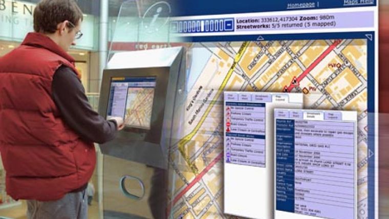
UK local authorities can now offer live street works information and maps on their websites thanks to the latest innovation from UK software firm Mayrise Systems. The company has launched a new version of VueNow, a web integration tool that enables live street works information to be made available instantly to web applications and contact centre systems.
Visitors to council websites can enter a street name or navigate using an intuitive map window to display a street works map of the area. Works are identified using different symbols to explain the nature of the works and clicking on the symbol provides more detailed information such as the start and finish dates and the utility concerned.
The innovation involves integration between the website and MAYRISE Street Works, a back office street works management system which is currently used by over a hundred UK councils. When website visitors view details they are seeing live information that is being streamed directly from the MAYRISE system. The information is therefore current and as well as keeping residents informed, it is also useful internally to different departments and to contact centres where it can be integrated with GIS and Customer Relationship Management (CRM) systems.

Value staying current with geomatics?
Stay on the map with our expertly curated newsletters.
We provide educational insights, industry updates, and inspiring stories to help you learn, grow, and reach your full potential in your field. Don't miss out - subscribe today and ensure you're always informed, educated, and inspired.
Choose your newsletter(s)


