Satellite Imagery of Israel's Fires
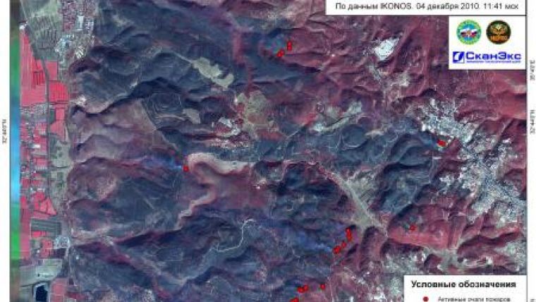
A satellite map of the Israeli disaster area was used by Emercom of Russia during their assistance in fire-fighting activities near Haifa city. Detailed imagery of IKONOS satellite from 4th December was used by ScanEx specialists to prepare and provide a satellite map of the fire-stricken are, where fire blazes and smoke plumes were detected.
The fires have been raging near the city of Haifa - the third in size city in Israel - starting 2nd December. According to the estimates of the experts over 2,000 hectares of forest have been burnt and over 40 people died. Fire brigades from Russia, Greece, France, Turkey and other countries took part in the fire-fighting activities.
Russian EMERCOM aviation completed fire extinguishing in Israel on 7th December after making sixteen flights at the Carmel Mountain (near Haifa). In all, over 40 aircrafts were used in fire fighting, including two Il-76 and two Be-200 amphibian aircrafts.

Value staying current with geomatics?
Stay on the map with our expertly curated newsletters.
We provide educational insights, industry updates, and inspiring stories to help you learn, grow, and reach your full potential in your field. Don't miss out - subscribe today and ensure you're always informed, educated, and inspired.
Choose your newsletter(s)


