Scottish Aerial Photography for Flight Simulator
Getmapping’s aerial photographic survey of Scotland is being compiled into a comprehensive set of terrain scenery by Horizon Simulation for the popular Microsoft Flight Simulator, ‘Generation X’ edition. The first volume which complements scenery of the whole of England and Wales was the Western Isles. It has been closely followed by the Shetland and Orkney Islands. These form part of a planned series of five ultra-high definition photographic sceneries, published by Playsims, that will ultimately cover the whole of mainland Scotland and its outlying islands.
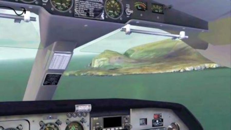
Modern computing power together with advances in remote sensing, have completely transformed Flight Sim software. The availability of nationwide high-resolution aerial photography and elevation data means that armchair pilots get the same magnificent views from their virtual cockpit that pilots enjoy in real flight. The result of course is more than entertainment as real pilots can now rehearse flights and practice their VFR navigation skills over some of the most dramatic, unspoilt landscapes in the UK.
The detailed aerial photographic scenery (at 60cm/pixel), provides crisp, sharp scenery textures, even at low altitudes and it is draped over a minutely detailed terrain mesh (at better than 5m/pixel), which realistically simulates every lump and bump of the topography in the scenery area, especially important where the landscape is characterised by mountains, valleys, towering cliffs and seascapes.
“We have been supplying data to Horizon Simulation for a number of years now and it has proved extremely popular with pilots and enthusiasts within the ‘flight sim’ community,” said Tristram Cary, Managing Director of Getmapping. Microsoft Flight Simulator has evolved into a sophisticated tool for pilots and flight enthusiasts alike and when combined with high quality terrain data and our own high resolution aerial photography, it really does become possible to practice under Visual Flight Rules,” continued Cary.

Value staying current with geomatics?
Stay on the map with our expertly curated newsletters.
We provide educational insights, industry updates, and inspiring stories to help you learn, grow, and reach your full potential in your field. Don't miss out - subscribe today and ensure you're always informed, educated, and inspired.
Choose your newsletter(s)


