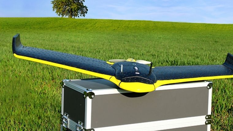
senseFly Adds Multispectral Sensor to eBee Ag UAV
Swiss professional UAV manufacturer senseFly has confirmed that Parrot’s Sequoia multispectral sensor – announced in early February at World Ag Expo in Tulare, California, USA and due to launch in March 2016 – will be immediately available for its eBee Ag UAV. Sequoia is one of the smallest and lightest multispectral UAS sensor released to date. It captures images of crops across four highly defined, visible and non-visible spectral bands, plus RGB imagery. In just one flight, agronomists, crop consultants and farmers can capture all the aerial data required to monitor and respond to the health of crops throughout the growing season.
eBee Ag users will be able to benefit immediately from Sequoia’s performance, said Jean-Christophe Zufferey, CEO and co-founder of senseFly. This will allow them to collect more actionable crop data than ever before, over much larger areas than multi-rotor drones can cover, and with the confidence that comes from using the drone rated number one in sub-1kg performance, all backed by professional senseFly support.
Multispectral and RGB
Sequoia includes four 1.2MP sensors that capture data over four spectral bands (near-infrared, red-edge, red and green), plus a 16MP RGB sensor, allowing both analytical data and visible imaging to be captured in the same flight. With this spectral breadth, up to hundreds of acres of actionable data can be collected.
This data can then be easily integrated into the eBee’s full drone-to-tractor workflow. Using photogrammetry software such as Pix4Dmapper, Sequoia’s hi-res imagery can be processed into orthophotos and index maps showing crop health. After careful analysis, these can be transformed into optimised application maps and exportable prescriptions – helping farmers to apply exactly the right amount of water or chemicals needed to boost yields and increase net profit.
Accurate results
To make effective business decisions, such as how much nitrogen to apply, it is crucial to attain accurate imagery, whatever the light conditions. Sequoia’s upward-facing Sunshine sensor measures irradiance – the current light conditions – and automatically calibrates Sequoia’s multispectral sensors to ensure high-quality data, also on cloudy or hazy days, for consistent measurements over time, and without the need to use a calibration tile before flight. Sequoia will cost significantly less than existing multispectral UAS sensors, bringing scientific-grade aerial imaging within reach of more ag professionals around the world.
eBee Ag
Customers will be able to purchase the eBee Ag with Sequoia. Existing eBee Ag users will be able to use Sequoia with their systems and, in future, Sequoia owners who fly non-senseFly UAVs will gain a simple upgrade path to it.
Customised data capture
The eBee Ag’s eMotion software enables Sequoia owners to specify exactly the level of data they require: choose between high- or low-resolution imagery, and whether or not RGB data is required alongside Sequoia’s multispectral results – all as part of eMotion’s one-click flight planning process.

Value staying current with geomatics?
Stay on the map with our expertly curated newsletters.
We provide educational insights, industry updates, and inspiring stories to help you learn, grow, and reach your full potential in your field. Don't miss out - subscribe today and ensure you're always informed, educated, and inspired.
Choose your newsletter(s)


