Sharing Essential Environmental Data for Quicker Emergency Response
GGP Systems, UK, is helping local authorities to respond quicker to environmental disasters by sharing essential environmental data under the European Directive INSPIRE. INSPIRE requires public authorities to publish geospatial information related to the environment, such as data about land use, planning and transport, according to strict technical specifications.
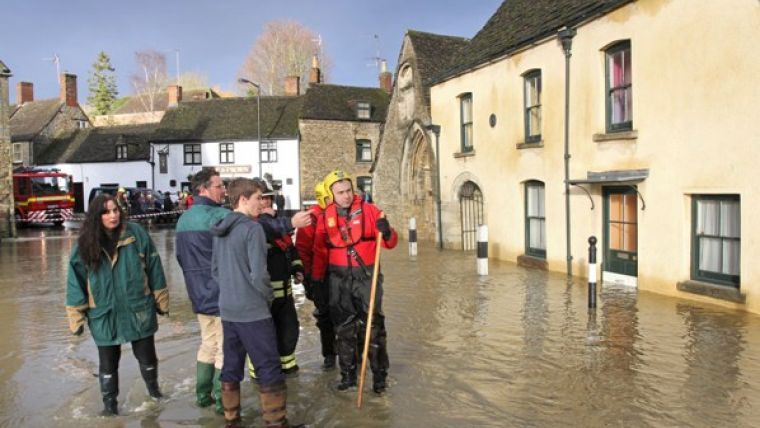
Publishing of environmental data is designed to enable the cross border and cross agency sharing of information which is vital in helping to respond to, plan for and prevent environmental emergencies such as the current flood events in the UK.
Geographical information systems specialist GGP Systems has launched a number of specially designed work packages and off-the-shelf solutions that are already helping local authorities to publish data.
INSPIRE has been around for quite some time, commented Tim Maxwell, founder and managing director of GGP Systems. However, local authorities simply don’t have the time, budget or staff resource to stay on top of their obligations. By using a specialist contractor, such as GGP, under resourced, cash strapped councils can ensure data is not only published but that it is also compliant and maintained.
Quality data
However this is not just about compliance with the latest European directive, continued Maxwell. INSPIRE is grounded in the need for joined up decision making underpinned by quality data. Environmental emergencies, such as the devastating flooding across England, show just how important it is that those charged with managing the emergency response and clean-up operation have access to the most up to date and accurate information available.
The importance of INSPIRE was recently recognised with the announcement of funding by the Department of Environment, Farming and Rural Affairs (DEFRA) under the New Burdens Doctrine for Local Authorities. Grants of up to EUR8,000 are being made available to help local authorities meet regulatory compliance for the publishing geospatial information relating to the environment.
GGP Systems offers an end-to-end service to help local authorities and other public sector organisations meet their INSIRE obligations. With options available for the data providers and publishers, such as councils, for users of environmental data such as emergency responders and for central hubs, the GGP INSPIRE Service Packages represent proven functionality coupled with value for money.

Value staying current with geomatics?
Stay on the map with our expertly curated newsletters.
We provide educational insights, industry updates, and inspiring stories to help you learn, grow, and reach your full potential in your field. Don't miss out - subscribe today and ensure you're always informed, educated, and inspired.
Choose your newsletter(s)


