SimActive releases Correlator3D 10 with improved point cloud generation
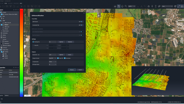
SimActive has announced the release of Correlator3D Version 10. This latest version comes with a completely redesigned user interface, featuring a new dark mode option, and also allows for point clouds to be generated at significantly higher densities. Additionally, new capabilities have been added, including the ability to add oblique imagery to improve results, colourize photogrammetric point clouds during their generation, and advanced filtering to eliminate less accurate points.
According to Louis Simard, CTO at SimActive, a world-leading developer of photogrammetry software, "off-nadir sensors are used more and more to capture imagery at oblique angles, giving the user a better look at structures, facades and other street-level features. Version 10 takes advantage of new image processing algorithms to capture these details, adding to nadir deliverables and enhancing modeling capabilities."
SimActive's Correlator3D software is a patented end-to-end photogrammetry solution for the generation of high-quality geospatial data from satellite and aerial imagery, including drones. The software performs aerial triangulation (AT) and produces dense digital surface models (DSM), digital terrain models (DTM), point clouds, orthomosaics, 3D models and vectorized 3D features. The company has been selling its software solution to leading mapping firms and government organizations around the world.
To learn more about Correlator3D Version 10, see here.

Value staying current with geomatics?
Stay on the map with our expertly curated newsletters.
We provide educational insights, industry updates, and inspiring stories to help you learn, grow, and reach your full potential in your field. Don't miss out - subscribe today and ensure you're always informed, educated, and inspired.
Choose your newsletter(s)


