SimActive’s Correlator 3D Enriched with Cloud Sharing and Reflectance Calibration
This article was originally published in Geomatics World.
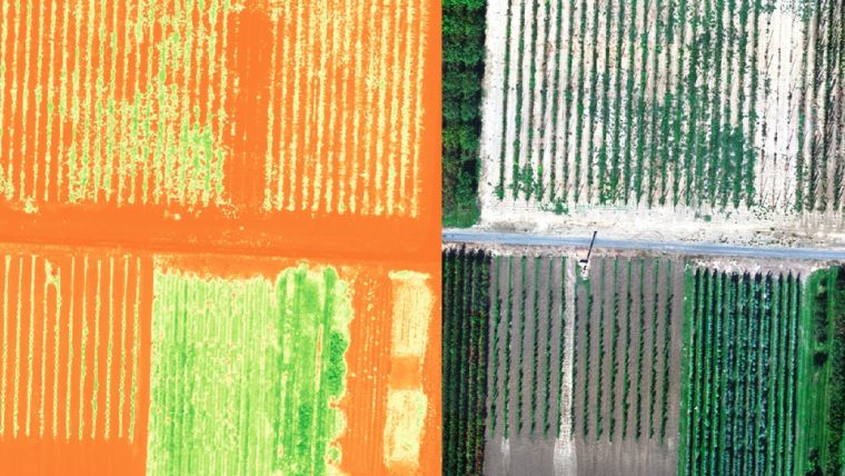
SimActive, the Canada-based leading developer of photogrammetry software, has announced the release of Correlator3D version 8.5. The new version allows users to share and visualize projects in the cloud. It also features new tools for the calibration and processing of multispectral imagery.
Specifically, results can be exported to the cloud directly from the software interface, and shareable links are automatically created for online visualization. Moreover, calibrated reflectance panels and sun sensors can be used to produce reflectance maps, with multispectral bands perfectly registered.
“Our software attracts a variety of clients, with a wide range of needs”, said Louis Simard, CTO at SimActive. “This new version brings advantages to customers with data exploitation requirements such as online viewing, and to users processing imagery from highly sophisticated sensors.”
The Correlator3D software suite is a patented end-to-end photogrammetry solution for the generation of high-quality geospatial data from satellite and aerial imagery, including UAVs. Correlator3D performs aerial triangulation (AT) and produces dense digital surface models (DSM), digital terrain models (DTM), point clouds, orthomosaics, 3D models and vectorized 3D features.

Value staying current with geomatics?
Stay on the map with our expertly curated newsletters.
We provide educational insights, industry updates, and inspiring stories to help you learn, grow, and reach your full potential in your field. Don't miss out - subscribe today and ensure you're always informed, educated, and inspired.
Choose your newsletter(s)


