SimActive Software Enables Processing of Wingtra UAV Data
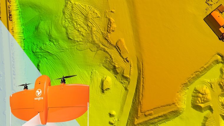
SimActive, a leading Canada-based developer of photogrammetry software, has announced that Correlator3D is being used for mapping projects acquired by Wingtra and its high-end vertical take-off and landing (VTOL) unmanned aerial vehicle (UAV or 'drone'), WingtraOne. Wingtra entered the market in early 2017 and is an innovative and rapidly growing VTOL drone producer for geospatial professionals.
“The high-quality data collected with our WingtraOne PPK drone is well supported by the rigorous workflow of Correlator3D,” said Basil Weibel, CRO at Wingtra. “Our customers can generate extremely good quality maps and surface models on the SimActive platform even for very large projects.”
“SimActive software and WingtraOne imagery is a great match, combining high accuracy and very high resolution,” said Francois Gervaix, technical advisor at SimActive. “As an example, the combination allows for accurate volume calculation and extraction of spotless contour lines.”
Headquartered in Switzerland, Wingtra aims to become the world’s leading VTOL drone manufacturer for the mapping, survey and mining industry. Since its market entry in early 2017, Wingtra has partnered with more than 50 of the biggest equipment dealers and has been selling mapping drones globally ever since.
SimActive is the developer of Correlator3D software, a patented end-to-end photogrammetry solution for the generation of high-quality geospatial data from satellite and aerial imagery, including UAVs. Correlator3D performs aerial triangulation (AT) and produces dense digital surface models (DSM), digital terrain models (DTM), point clouds, orthomosaics, 3D models and vectorized 3D features. SimActive has been selling Correlator3D to leading mapping firms and government organizations around the world, offering cutting-edge photogrammetry software backed by exceptional customer support.

Value staying current with geomatics?
Stay on the map with our expertly curated newsletters.
We provide educational insights, industry updates, and inspiring stories to help you learn, grow, and reach your full potential in your field. Don't miss out - subscribe today and ensure you're always informed, educated, and inspired.
Choose your newsletter(s)


