SIRIUS UAV for Australasia
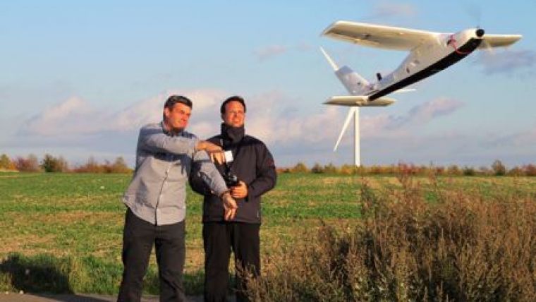
The Australian company Position Partners has announced an Unmanned Aerial Vehicle (UAV) for the Australasian civil construction, photogrammetry, mining and agricultural industry: SIRIUS UAV by MAVinci. Designed for a wide range of survey applications, the SIRIUS UAV is a fixed wing structure ideal for corridor mapping roads, pipelines and power lines, calculating stockpile volumes, monitoring erosion, reconciliation and progress reporting.
Weighing 3kg and with a wingspan of 1.6 metres, SIRIUS is suited for one-man operation. Unlike manned flyovers that are often delayed due to weather conditions or cloud cover, SIRIUS can fly under cloud and despite strong winds and rain.
SIRIUS can capture images defined by irregular shapes, reducing the amount of data processing to the specific area of attention. The UAV also gives the user greater control during flight, with 'fully automatic' mode supported by 'autopilot assisted' mode or 'fully manual' mode. This flexibility is better for landing management, enabling navigation around any unforseen obstacles.
To complete an aerial survey, users simply program in a flight plan using the included desktop flight planning software. Load the flight plan onto the UAV, stand at the desired take-off area and launch the SIRIUS by switching on autopilot and throwing it into the air.
Once airborne, SIRIUS will fly the pre-planned route, taking multiple images with a high-resolution on-board camera. It then begins its descent to the programmed landing area so that the images can be post-processed.

Value staying current with geomatics?
Stay on the map with our expertly curated newsletters.
We provide educational insights, industry updates, and inspiring stories to help you learn, grow, and reach your full potential in your field. Don't miss out - subscribe today and ensure you're always informed, educated, and inspired.
Choose your newsletter(s)


