Slum Identification Mapping and Monitoring
From 21st to 23rd May, about 20 key scientists and practitioners will convene at ITC Enschede (Netherlands) for an expert group meeting on slum identification, mapping and monitoring. The focus of the meeting is to document methods for the identification and delineation of slum areas based on high resolution remote sensing images and supplementary data sets, e.g. census and related GIS data on infrastructure and services. This allows the formulation of a global strategy to collect sufficient and reliable information at the sub-city level and to link that to information at the city level.
The need for identification of slum areas is growing rapidly, as the number of slum in cities all over the world is increasing and their quality is deteriorating. It is expected that the number op people living in slums will grow up to 1.4 billion in 2020. Yet, the identification of slums is problematic for various reasons:
- Many local governments do not have mechanisms to monitor urban growth in a systematic manner, even less to monitor informal urban growth. According to UNHABITAT, 80 cities out of 120 recognise that they do not possess monitoring systems to track changes in the spatial dimension of the city (Urban Indicators Programme, 2005).
- Slums are often the invisible part of the city; they are zones of silence in terms of public knowledge, opinion and discussion about urban poverty (Slums of the World, 2003).
- Slums, as part of informal growth, are more important than formal growth in many cities of the developing world. Yet, these invisible areas grow faster than the visible areas. Most governments do not report on slum conditions and trends.
- Different countries maintain different standards and information, quite often coloured by political considerations, which makes difficult their recognition by local authorities.
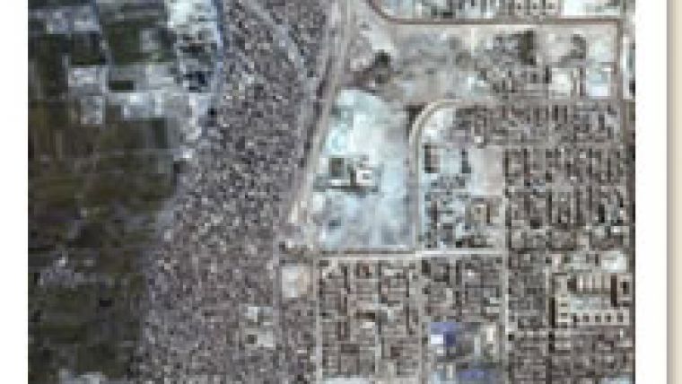
Caption: Slum pockets in Cairo, Egypt (Ikonos image 2000)

Value staying current with geomatics?
Stay on the map with our expertly curated newsletters.
We provide educational insights, industry updates, and inspiring stories to help you learn, grow, and reach your full potential in your field. Don't miss out - subscribe today and ensure you're always informed, educated, and inspired.
Choose your newsletter(s)


