Software for Spatial Imaging
Trimble Access software for Spatial Imaging is an addition to Trimble's Connected Site solutions. Trimble Access is a streamlined field and office solution for surveyors and geospatial professionals that expedites spatial imaging data collection, processing, analysis, and project information delivery. This solution enables the ability to create in-field deliverables and more efficient collaboration and connectivity between project team members.
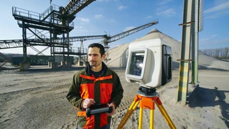
Trimble Access for Spatial Imaging is designed to complement the intelligent scanning capabilities of the Trimble GX 3D scanner, which features Trimble's SureScan technology. SureScan maintains a user-defined, equal density of points so that surveyors and geospatial professionals can collect and process data faster by focusing on collecting the right points, not just more points. The software runs on the Trimble Tablet rugged PC, which includes a wide screen, Internet connectivity, and the computing power to process large scans and view large scenes.
Similar to Trimble Access for Integrated Surveying applications, Trimble Access for Spatial Imaging suite of software consists of three components: base software for typical scanning activities, specialized application modules and the Trimble Connected Community.

Value staying current with geomatics?
Stay on the map with our expertly curated newsletters.
We provide educational insights, industry updates, and inspiring stories to help you learn, grow, and reach your full potential in your field. Don't miss out - subscribe today and ensure you're always informed, educated, and inspired.
Choose your newsletter(s)


