Start-up Wingtra Expands UAV Solutions to China and US
After being released earlier this year, the WingtraOne UAV is now spreading its wings across continents, with the first stop in the USA and China. According to Wingtra, the company behind the drone, users come from areas as diverse as surveying, precision farming, glacier monitoring and wildlife monitoring. Within the space of just a few months, the start-up is swiftly gaining popularity among professional mappers and surveyors.
The Swiss company focuses on the combination of high range and usability. With the drone technology emerging rapidly, users have been turning to the Unmanned Aerial Vehicle market for aerial data collection. However, the choice has typically been between fixed-wing aircraft and multirotors. Fixed-wing aircraft offer long range but can be too cumbersome to use. Either they need long runways, limiting the options for take-off, or need catapults. In contrast, multirotors offer great flexibility for take-off and landing, and in turn, ease of use. However, they are severely limited in flight time and speed – the most popular quadcopters, for example, can only offer a flight time of around 20 minutes covering roughly 40 hectares.
Best of both worlds
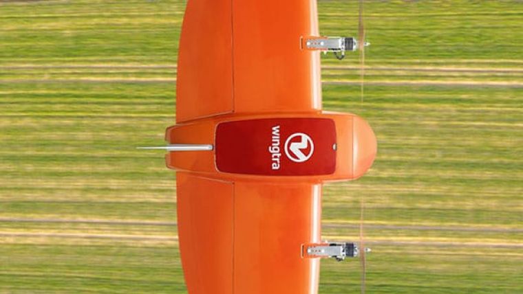
This gap between usability and high range is what the WingtraOne aims to bridge. It is designed as a tailsitter drone that takes off and lands vertically (VTOL) like a multirotor, but flies like a fixed-wing airplane in air. This efficiency in flight gives it a flight time of up to 55 minutes covering anywhere between 280 and 400 hectares at 3cm/px GSD depending on the specific sensor – the same area as 570 football fields.
This ease of use is greatly amplified by its flight planning software, WingtraPilot. The process of planning a survey takes roughly 5 minutes. Then, with the press of a button, the WingtraOne takes off, collects aerial imagery, and lands — all fully autonomously. The user does not have to worry about needing any pilot training.
With its high payload capacities, the WingtraOne offers a variety of high end sensors to generate high resolution imagery for orthophotos, 3D reconstructions, cloud points and NDVI maps. Wingtra’s selection include the 42 megapixel full-frame Sony RX1RII. Thanks to the vertical landing, the cameras are well-protected and are never at a risk of damage by belly landings.
Intergeo 2017
With this array of wide-ranging benefits, Wingtra is keen on demonstrating the WingtraOne’s capabilities at InterGeo 2017 – which has long been a favorite in the geospatial community. InterGeo 2017 will be held in Berlin from 26-28 September. Interested users can take a look at the WingtraOne display in hall 6.1, booth IAS.B025 and have a look at www.wingtra.com.

Value staying current with geomatics?
Stay on the map with our expertly curated newsletters.
We provide educational insights, industry updates, and inspiring stories to help you learn, grow, and reach your full potential in your field. Don't miss out - subscribe today and ensure you're always informed, educated, and inspired.
Choose your newsletter(s)


