StreetMapper Mobile Laser System to Map Indian Infrastructure
StreetMapper is being deployed to laser-map city centres and transportation networks across India. The StreetMapper mobile laser-mapping system has been purchased by Geokno, a technology company specialising in GIS, following the recent announcement of another USD400 million of funding to boost investment in Indian infrastructure.
The specially customised StreetMapper was selected for its accuracy, reliability and quality of support and service from developer 3D Laser Mapping. The system will be immediately deployed on two highway projects before being showcased for the first time ever in India at the India Geospatial Forum taking place at the Hyderabad International Convention Centre from the 5 to 7 February 2014.
India is making significant investment to improve its physical infrastructure, commented Prof Dr. Bharat Lohani, director and Mr Balaji Nagarajan CEO of Geokno Indian Private Limited (a GMR Group company), which is why they are applying the very latest and best mobile mapping technology. One of the primary requirements, and fundamental to the selection of the StreetMapper system, was the requirement for engineering grade survey data. They also needed to be confident in the field performance and reliability of the system to minimise downtime.
Geokno is a spin-off company from the Indian Institute of technology Kanpur specialising in GIS and related technologies such as Lidar based surveying. Recognising the technical strengths of the company and the potential of the technology the GMR Group – one of the fastest growing infrastructure enterprises in the country, acquired a majority stake in Geokno.
Mobile and aerial mapping
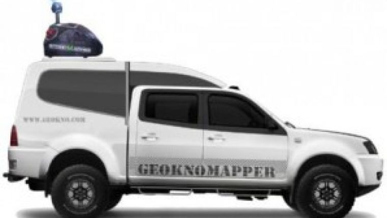
Developed by UK-based 3D Laser Mapping, in conjunction with German guidance and navigation specialists IGI, the StreetMapper system purchased by Geokno included two high-speed, non-contact laser scanners specifically designed for mobile mapping as well as an export licence free fibre optic based Inertial Measurement Unit (IMU). The pod system also included a high-resolution camera, specially designed lifting platform and a custom designed canopy. The newly supplied StreetMapper system can also be used for aerial projects with an airborne mount for the laser scanners and IMU.
StreetMapper has been specifically designed for the rapid 3D mapping of highways, runways, railways, infrastructure and buildings. Using vehicle-mounted lasers offering a 360-degree field of view, StreetMapper enables high precision mapping to a range of 800 metres, a capacity of 550,000 measurements per second per sensor and recorded accuracies in independent real world projects of better than 10 millimetres.

Value staying current with geomatics?
Stay on the map with our expertly curated newsletters.
We provide educational insights, industry updates, and inspiring stories to help you learn, grow, and reach your full potential in your field. Don't miss out - subscribe today and ensure you're always informed, educated, and inspired.
Choose your newsletter(s)


