Surveying in Challenging Places
Many locations on Planet Earth are challenging places for surveyors to work. We’ve selected a number of extraordinary mapping projects in remote and scenic areas, each requiring a different approach to get the job done as effectively as possible. Join us on this journey around the world illustrating the diverse and exciting nature of our profession!
The Challenges of Surveying the Faroe Islands
Remotely situated in the northern Atlantic Ocean, roughly equidistant from Scotland, Iceland and Norway, the Faroe Islands form a rugged and rocky archipelago. The cool and cloudy weather, with strong winds and heavy rain possible all year round, means that this is a challenging survey environment. In its search for the best method to capture this stunning environment, the mapping authority has turned to UAVs. This article tells the story of mapping and surveying a truly breathtaking spot on Earth.
Read the full story here
The Beirut Explosion: UAV Mapping as a First Step to Recovery
Pix4D provided software and processing solutions in a recent UAV mapping project by Augment to assess the damage caused by the devastating explosion of an ammonium stockpile in Beirut in August 2020. As a small Luxembourg-based company with employee roots in Lebanon, the Augment team felt the irresistible urge to go and help when the explosion happened. Augment specializes in digital facility management through the creation of as-built models of facilities called Augment Information Models (AIM), enriched with facilities management information.
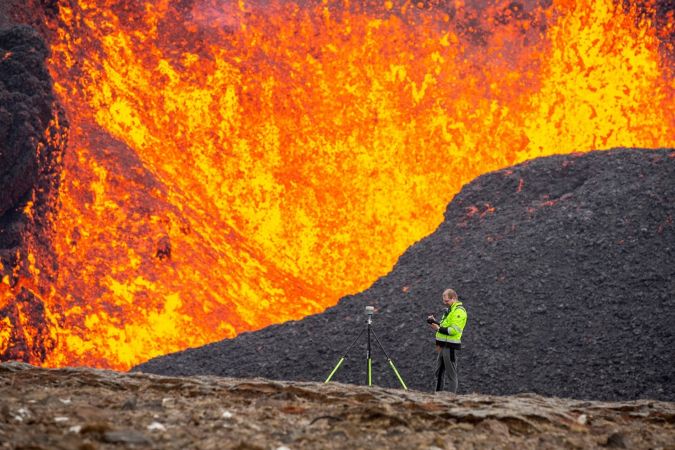
Surveying in the Land of Fire and Ice
Geodesists and surveyors in Iceland face considerable challenges due to the deformation effects of earthquakes, volcanic eruptions and glaciers on the geodetic networks. This article provides insight into the impact of this dynamic situation on the country’s geodetic datums over the past decades.
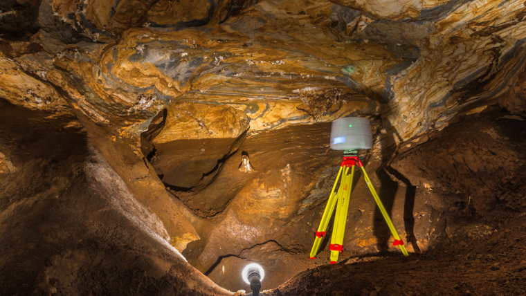
High-resolution Topography of a World Heritage Cave
TLS and SfM photogrammetry have been used for the geodetic surveying and 3D mapping of the Ochtiná Aragonite Cave in Slovakia. This world-famous karst landscape of significant geological, geomorphological and mineralogical value represents a combined labyrinth consisting of parallel tectonically controlled halls and passages. The new detailed map, sections and 3D model create an innovative platform for a more detailed study of the morphology and genesis of this unusual cave, including for its environmental protection and use in tourism.
Using Lidar North of the Arctic Circle
This aerial acquisition mission in Greenland was made all the more challenging by the unique Arctic location. Precise geodata is considered vital to support almost all aspects of community activities and future development on the world's biggest island.

Value staying current with geomatics?
Stay on the map with our expertly curated newsletters.
We provide educational insights, industry updates, and inspiring stories to help you learn, grow, and reach your full potential in your field. Don't miss out - subscribe today and ensure you're always informed, educated, and inspired.
Choose your newsletter(s)


